Three government departments are joining together for a new mission that will provide detailed information on wildfires across Canada from far above it.
"WildFireSat" aims to launch satellites into space in 2029 that can accurately monitor all wildfires burning across the country while providing detailed 30-minute updates throughout the day.
It's a partnership between the Canadian Space Agency (CSA), Natural Resources Canada (NRC) and Environment and Climate Change (ECC) Canada funded in the 2022 budget for about $169.9 million.
Using infrared sensors, the satellites will be able to measure the energy —known as fire radiative power — emitted by the blazes.
Right now, there are no satellites that can monitor the peak burning period of a fire, which is mid to late afternoon, Miriam Micael, engineering project manager with CSA, said.
WildFireSat aims to change that.
"WildFireSat is actually really looking to close that gap," she told CTVNews.ca in an interview. "By allowing fire managers to receive the data within 30 minutes, put it into the algorithms and really spit out these fire data products, they're actually going to be better equipped and prepared."
Micael says due to Canada's location, this satellite data does not currently exist.
"WildFireSat was created to really capture information at that time and then use and take data and integrate it into tools for our fire managers," she said.
THE GOAL OF WILDFIRESAT
The mission has three distinctive goals, the Government of Canada website says.
The first is to provide detailed mapping of a fire's burn perimeter and monitor all fires across the country, including ones in remote areas.
The project will allow for predictions on where and how strong the fire could burn depending on weather conditions and the fuels in the region.
WildFireSat is also expected to show detailed smoke mapping and predictions for where it could travel and up-to-date air quality monitoring.
"So when paired with other information, and I am thinking about complimentary satellite instruments that observe what is in the air, the result is a powerful combination," Chris McLinden, research scientist with ECC, told CTVNews.ca in an email.
This data can be collected and then help with further research on wildfires, McLinden said.
"One thing this allows us to do is learn about the links between fire temperature and size, fuel type (e.g., what kind of trees), meteorology, and how much pollution is released," he said.
In addition, the mission will measure the carbon emitted by wildfires, which will helps the country understand how impactful the blazes can be on carbon emission targets.
Currently, CSA is narrowing down contractors for the project and hoping to name the winner in 2024. There will be fewer than 10 satellites monitoring the country for wildfires, Micael said.
The project will give real-time data to communities and the people on the ground fighting wildfires for faster responses and aid them in making informed decisions.
"It will allow us to better protect our resources, infrastructure, and environment by providing better situational awareness, particularly near inhabited areas," the website reads.
Fires play a vital part in the regeneration of nature and sometimes when they aren't a threat to people they're left to run their course.
However, all wildfires need to be monitored, often by aircraft surveillance in remote areas, the government website says. WildFireSat would remove the need for aircraft by monitoring wildfires from space.
'WE SEE THE URGENCY'
This project has been under development since 2014, undergoing rigorous reporting, Micael said.
However, the launch of the project is a number of years away despite the need for the data right now.
"We fully understand and we see the urgency, and we're looking to also work as fast as possible and build a quality product," Micael said.
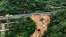
Canada's 2023 wildfire season is the worst in the country's history. It displaced thousands of people, destroyed homes from coast to coast and burned millions of hectares of land.
"The time it takes to design, build, and then of course, launch and then really get into operations….We know it's a long time," Micael said. "We've seen how it's destroyed homes and lives…We want to do our part to really help and assist in the best way that we can."