Environment Canada issued multiple weather warnings and statements across Canada on Monday.
From air quality advisories to upwards of 30 cm of snow, June in Canada is a mixed bag of weather.
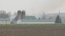
For most of the month, communities from B.C. to Quebec have been battling wildfires, as pressing dry temperatures blanketed most of the northern Canada and the Prairies.
As the forecast shifts, some areas needing rain will likely see precipitation over the next few days but it could cause more issues as localized flooding is possible.
Other parts of Canada are experiencing heat warnings that could exacerbate the wildfire situation and create more smoke pollution.
Here's what to expect over the next few days in Canada.
SMOKE AND SNOW
A weather pattern is creating a mix of precipitation for the B.C. interior and western Alberta.
Environment Canada issued a special weather statement for Fraser Canyon, B.C. on Monday calling for heavy rain. The low-pressure system spreading from Alberta is bringing 20 to 40 mm of rain throughout the day into Tuesday to the communities of Ashcroft, Cache Creek and southern Chilcotin.
The same weather system is expected to drop a mixture of snow and rain along the Coquihalla Highway around Kamloops.
"The snow level has lowered to approximately 1,500 metres this evening and low snow levels will persist until Tuesday morning," the weather statement from Environment Canada reads.
Lisa Ervin, an Environment Canada meteorologist, told CTV News Vancouver the air mass is dropping temperatures by five to 10 degrees across the province.
"June-uary has arrived," she said.
Flurries are expected over the Okanagan Connector and rain showers could occur near Allison Pass and Helmer Lake Summit.
In the northern parts of B.C., the story is very different.
A number of wildfires continue to burn in the north, including the Donnie Creek wildfire, which officials have dubbed the largest fire in the province's history. The fire has grown to about 5,343 square kilometres, which is almost the same size as P.E.I. (which is 5,660 square kilometres).
Special air quality statements blanket the northern half of B.C. from Prince George to Fort Nelson with smoke expected to impact the communities the most over the next 24 to 48 hours, Environment Canada says.
ALMOST A FOOT OF SNOW
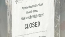
Alberta is expected to see similar conditions, with significant amounts of rain and snow in the forecast.
The low-pressure system is bringing a period of heavy rain to the communities around Edmonton. Environment Canada predicts 40 to 80mm could fall by Tuesday morning, which could cause flash floods.
"The rain not only helps impact fire behaviour, but it also really pulls all of that smoke out of the air and cleans it. It's like pressure washing the lower atmosphere," Kelsey McEwen, CTV Your Morning's chief meteorologist, said on Your Morning on Monday.
Environment Canada issued a snowfall warning for Highway 93 in Alberta and is expecting 15 to 25 cm to fall by Tuesday morning.
A bit further north on the Yellowhead Highway, connecting Jasper, Alta., to B.C., a special weather statement is in effect due to the possibility of mixing rain and snow.
DRIER CONDITIONS EASTWARD
Portions of Saskatchewan are under air quality statements from Environment Canada due to wildfire smoke.
Communities north of Prince Albert, Sask. including La Ronge, Stanley Mission and Buffalo Narrows have stable air qualities as of Monday morning but Environment Canada says this could "fluctuate over short distances and can vary considerably from hour to hour."
A similar advisory has been issued for one portion of Manitoba for the communities of Leaf Rapids and Lynn Lake.
The dry heat from the Prairies last week has moved to Ontario on Monday, as the northwestern part of the province is under a heat warning from Environment Canada.
The warning stretches from Kenora to Attawapiskat and Environment Canada predicts temperatures will range in the high 20s to low 30s and is likely to persist into Wednesday.
"Not only are we seeing significantly warmer-than-average temperatures in the northern part of the province, but this high pressure has also contributed to a reduction in the air quality," McEwen said.
Environment Canada has issued an air quality statement for Timmins, Cochrane and Iroquois Falls, Ont. The same statement is also in effect for parts of Quebec including along the northern border with Ontario.
Just west of Quebec City, a large portion of the province is under an air quality statement. Communities like Parent, Nemaska and as far north as Umiujaq, Que., along the Hudson Bay are seeing poorer air due to wildfire smoke.
"We're getting into those higher concentrations of smoke thanks to the fires burning in southwest Quebec," McEwen said. "That will continue for the next couple of days as this high pressure really remains quite dominant in the region."