
Quebec man who threatened Trudeau, Legault online sentenced to 20 months in jail
A Quebec man who pleaded guilty to threatening Prime Minister Justin Trudeau and Premier François Legault has been sentenced to 20 months in jail.


While its December forecast may have been "busted," The Weather Network reports that Canada could still see cold and snowy weather between Christmas and New Year's Day.
The recent update from meteorologist Doug Gillham says while seasonal forecasts called for a warmer-than-normal fall and a mild "come-and-go winter," with above normal temperatures, sandwiched in between were calls for a period of more consistent winter weather for the end of November and the month of December.
"That forecast is definitely running off the rails," Gillham writes.
"We specifically highlighted that the weeks leading up to Christmas would be more conducive to skiing rather than golf. While I don't think many people were golfing this past week, the weather during the next seven days will be brutal for skiers."
Gillham points to a change in the jet stream in mid-November that happened as expected.
However, temperatures across northern Canada remained "exceptionally" warm, meaning cold fronts from the north simply knocked temperatures back down to normal.
By the end of November, some Arctic air did pass south through Ontario and Quebec at least a couple of times before losing "some of its bite" as it travelled across the Great Lakes, which saw record warm temperatures after this past fall and summer.
Despite some "significant" lake-effect snow events, the cold weather was never able to "lock in" for more than a few days, Gillham says.
He points to an "exceptionally powerful jet stream" over the Pacific Ocean as the key reason that brought a "parade of storms" to the B.C. coast and spread mild Pacific air east across the U.S. and southern Canada, resulting in an extended stretch of above normal temperatures for Ontario and Quebec.
As the Pacific jet stream slows, frigid weather is expected to build across Alaska and Western Canada, resulting in a weather pattern similar to what was previously forecast for January and February.
But as for whether most of Canada will see a white or green Christmas this year, Gillham says that will "likely come down to the wire."
He writes that several "dominos" will have to fall just right to create a period of consistent winter weather these holidays.
The most critical of these will be the change in the jet stream pattern over the Pacific Ocean and into Alaska, which could set the stage for a few weeks of cold and snowy conditions over the holidays and well into early January.
"However, if the jet stream pattern fails to evolve as expected over the Pacific Ocean, then dust off the golf clubs — mild weather will continue to dominate," he said.
A Quebec man who pleaded guilty to threatening Prime Minister Justin Trudeau and Premier François Legault has been sentenced to 20 months in jail.
Pius Suter scored with 1:39 left and the Vancouver Canucks advanced to the second round of the NHL playoffs with a 1-0 victory over the Nashville Predators on Friday night in Game 6.
The adorable trio of child actors from the 1993 classic comedy 'Mrs. Doubtfire,' which starred the late and great Robin Williams, are all grown up and looking back on their seminal time together.
The Ukrainian village of Ocheretyne has been battered by fighting, drone footage obtained by The Associated Press shows. The village has been a target for Russian forces in the Donetsk region of eastern Ukraine.
A source close to singer Britney Spears tells CNN that the pop star is 'home and safe' after she had a 'major fight' with her boyfriend on Wednesday night at the Chateau Marmont in West Hollywood.
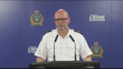
Three people have been arrested and charged in the killing of B.C. Sikh activist Hardeep Singh Nijjar – as authorities continue investigating potential connections to the Indian government.
Crucial witnesses took the stand in the second week of testimony in Donald Trump's hush money trial, including a California lawyer who negotiated deals at the center of the case and a longtime adviser to the former president.
As Wegovy becomes available to Canadians starting Monday, a medical expert is cautioning patients wanting to use the drug to lose weight that no medication is a ''magic bullet,' and the new medication is meant particularly for people who meet certain criteria related to obesity and weight.
The erstwhile group of senators and MPs studying the federal government's invocation of the Emergencies Act over the "Freedom Convoy" was supposed to present its findings in December. December of 2022, that is.

Pius Suter scored with 1:39 left and the Vancouver Canucks advanced to the second round of the NHL playoffs with a 1-0 victory over the Nashville Predators on Friday night in Game 6.
A former Mountie who pleaded guilty to illegally employing a foreign national without a work permit has been ordered to pay a $2,000 fine and have no contact with her former nanny for two years.
Three people have been arrested and charged in the killing of B.C. Sikh activist Hardeep Singh Nijjar – as authorities continue investigating potential connections to the Indian government.

York Regional Police say they are continuing to search for a suspect in an auto theft investigation who was captured on video running over a police officer in Toronto last month.
A 60-year-old man and a 55-year-old woman killed in a wrong-way crash on Highway 401 earlier this week have been identified by the Consulate General of India in Toronto.
Video of a suspect lighting a Richmond Hill barbershop on fire earlier this week has been released by police.
As of Friday morning, 611 Calgarians had voiced their opinions about the city's proposed blanket rezoning, with 92 still remaining.
Many in Calgary’s film industry are worried about the potential sale of another iconic downtown theatre, and what it could mean for the local arts scene.
Mandatory Alcohol Screening has been in place in Alberta for the past few years and a move by the Ontario Provincial Police to begin enforcing breath samples at all traffic stops is being applauded by local victims of impaired driving.

Ottawa Fire Services says crews battled a fire that broke out in a bedroom in the same highrise building that displaced hundreds of residents and sent three people to hospital in critical condition Thursday morning.
Though the temperatures are warm this Saturday, it's going to be a rainy day in the capital.
A group of lawyers has written what they call a groundbreaking book about how mental health is perceived in the legal profession.

The province has been pushing drivers to make the switch to electric vehicles (EVs) but it appears Quebecers aren't buying in. The latest numbers from the SAAQ show that the number of gas-powered vehicles hit a record high in 2023.
Quebec semi-pro soccer team CS Saint-Laurent is set to face off against Toronto FC in the 2024 Canadian Championship in five days.
Quebec Premier François Legault reiterated that the pro-Palestinian encampment at McGill University must be dismantled while police remain 'on the lookout for new developments.'

The Edmonton Oilers will face the Vancouver Canucks in the second round of the National Hockey League post-season after Vancouver advanced with a 1-0 win over the Nashville Predators in Game 6 Friday, winning the best-of-seven opening-round series 4-2.
A man accused of arson in a January Old Strathcona apartment fire is expected to be charged with manslaughter after a body was discovered in the burned building late last month.
Federal tax changes could soon make it difficult for people to find a family doctor, says the Alberta Medical Association.
An initiative called the Mandatory Alcohol Screening (MAS) program is designed to cut down on the number of drunk drivers on the road in the Halifax area.
A New Brunswick woman suffering from sarcoidosis, a disease that limits your lung capacity, is in need of a double lung transplant.
Fishery officers seized nearly 30 kilograms of elvers at a Yarmouth County, N.S., holding facility on Wednesday, arresting three people in the process.
Winnipeg police say they have arrested two people in their 20s after a large amount of explosives were found in a home outside of Winnipeg, Man.
A Manitoba man who pleaded guilty to keeping the funds raised from an ice-fishing fundraiser for the Children's Hospital Foundation of Manitoba has been handed a sentence of 18 months house arrest.
A city committee has given the green light to an oversized garage, where no permit was pulled.

RCMP say human remains found in a rural area in central Saskatchewan may have been there for a decade or more.
Premier Scott Moe's Saskatchewan Party has received millions of more dollars in donations compared with rivals ahead of this year's election.
The North Central Family Centre (NCFC) has launched a capital campaign to help aid in the completion of a major project they are in the midst of building.

More than 100 teachers at the Waterloo Region District School Board (WRDSB) are learning they have been declared surplus will likely be out of a job as of Aug. 12.
There was a large police presence in a Kitchener neighbourhood Friday evening as officers searched for a missing 17-year-old.
People living in Puslinch, Ont. may have the answer to why their water smelled so bad last year.

A lesser known fixture of Saskatoon's skyline is coming down for repairs and renovations.
The Major Crime Section of the Saskatoon Police Service has taken over the investigation into the death of a 30-year-old man, marking the city’s 9th homicide in 2024.
Richelieu Hardware Canada Ltd. was fined a hefty $260,000 for a workplace safety violation leading to a serious worker injury.

The jury deciding the fate of a man responsible for a fatal firebombing in Sudbury found him guilty of three counts of first-degree murder Friday afternoon.
Three men from southern Ontario and a man from Texas have been fined a total of $16,700 for illegal hunting and fishing in September 2021.
A New Hamburg family is feeling deflated after buying a new Toyota hybrid truck.
In case you missed it, CTV News London has compiled all the top local stories from this week into one video for your convenience.
Municipal funding is running out for a temporary shelter program that serves homeless Londoners.
It looked like most other art exhibits, but the works on display at Fanshawe College were part of a healing process for the artists.
A trial date has been set for an Ontario senior facing allegations of historical sexual offences involving children.
A Barrie man is facing multiple charges related to incidents of intimate partner violence that originated in the Township of Essa.
On Thursday night, 30 firefighters battled a destructive fire that broke out in a facility in Bracebridge Ont.

In case you missed it, CTV News Windsor has compiled all the top local stories from this week into one video for your convenience.
A lesson learned at school saved a life Thursday.
A wet and muggy start to the weekend is expected across Windsor-Essex.
Pius Suter scored with 1:39 left and the Vancouver Canucks advanced to the second round of the NHL playoffs with a 1-0 victory over the Nashville Predators on Friday night in Game 6.
Three people have been arrested and charged in the killing of B.C. Sikh activist Hardeep Singh Nijjar – as authorities continue investigating potential connections to the Indian government.
When Damon Langlois visited the beach as a boy, he never would have imagined how significant sand would become in his life.

Out of more than 9,000 entries from over 2,000 breweries in 50 countries, a handful of B.C. brews landed on the podium at the World Beer Cup this week.
An emaciated dachshund is now recovering thanks to a Good Samaritan who found the pup near a biking trail in Kelowna, according to the BC SPCA.
Search and rescue crews have been called in after a vehicle belonging to a missing senior was located near a rural intersection outside of Kelowna Tuesday.

Animal shelters across the province are finding themselves frequently at capacity -- or more.
Lethbridge police say impaired driving is to blame in a fatal crash that killed a 25-year-old man on Thursday.
The bell at Erle Rivers High School in Milk River, Alta., will ring for the last time on June 26, as the 114-year-old school is scheduled to be torn down to make way for a new K-12 school.

The de-rostering of thousands of patients at the Group Health Centre in Sault Ste. Marie was the centre of attention at a town hall Friday organized by the Algoma chapter of the Ontario Health Coalition.
The Chi-Cheemaun ferry arrived at Manitoulin Island on Friday morning to kick off its 50th season on the Georgian Bay.
Phase 1 of the reconstruction of Queen Street in downtown Sault Ste. Marie is getting underway, although it will be scaled down from the original plan.

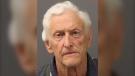
A funeral is being held today for hockey broadcasting legend Bob Cole in his hometown of St. John's, N.L.
Richard Martin is spending this year's fishing season on land after he says a Royal Newfoundland Constabulary officer broke his left leg in three places during a protest last month that shut down the provincial legislature.
Tributes continue to pour in for Bob Cole as his family has confirmed a funeral will be held for the legendary broadcaster Friday in St. John's, N.L.

Alberta Ballet's double-bill production of 'Der Wolf' and 'The Rite of Spring' marks not only its final show of the season, but the last production for twin sisters Alexandra and Jennifer Gibson.
A British Columbia mayor has been censured by city council – stripping him of his travel and lobbying budgets and removing him from city committees – for allegedly distributing a book that questions the history of Indigenous residential schools in Canada.
Three men in Quebec from the same family have fathered more than 600 children.
A group of SaskPower workers recently received special recognition at the legislature – for their efforts in repairing one of Saskatchewan's largest power plants after it was knocked offline for months following a serious flood last summer.
A police officer on Montreal's South Shore anonymously donated a kidney that wound up drastically changing the life of a schoolteacher living on dialysis.
Since 1932, Montreal's Henri Henri has been filled to the brim with every possible kind of hat, from newsboy caps to feathered fedoras.
Police in Oak Bay, B.C., had to close a stretch of road Sunday to help an elephant seal named Emerson get safely back into the water.
Out of more than 9,000 entries from over 2,000 breweries in 50 countries, a handful of B.C. brews landed on the podium at the World Beer Cup this week.
Raneem, 10, lives with a neurological condition and liver disease and needs Cholbam, a medication, for a longer and healthier life.

The erstwhile group of senators and MPs studying the federal government's invocation of the Emergencies Act over the "Freedom Convoy" was supposed to present its findings in December. December of 2022, that is.
Foreign interference by China did not affect the overall results of the 2019 and 2021 general elections won by Justin Trudeau's Liberals, a federal commission of inquiry has found.
Three people have been arrested and charged in the killing of B.C. Sikh activist Hardeep Singh Nijjar – as authorities continue investigating potential connections to the Indian government.

Black youth in Canada face multiple barriers in getting access to mental health services — and health-care providers can make the situation more difficult, experts say.
A New Brunswick woman suffering from sarcoidosis, a disease that limits your lung capacity, is in need of a double lung transplant.
As Wegovy becomes available to Canadians starting Monday, a medical expert is cautioning patients wanting to use the drug to lose weight that no medication is a ''magic bullet,' and the new medication is meant particularly for people who meet certain criteria related to obesity and weight.

Google's preeminence as an internet search engine is an illegal monopoly propped up by more than US$20 billion spent each year by the tech giant to lock out competition, U.S. Justice Department lawyers argued at the closings of a high-stakes antitrust lawsuit.
Many species of animals form social groups and behave collectively: An elephant herd follows its matriarch, flocking birds fly in unison, humans gather at concert events. Even humble fruit flies organize themselves into regularly spaced clusters, researchers have found.
China on Friday launched a lunar probe to land on the far side of the moon and return with samples that could provide insights into differences between the less-explored region and the better-known near side.

The adorable trio of child actors from the 1993 classic comedy 'Mrs. Doubtfire,' which starred the late and great Robin Williams, are all grown up and looking back on their seminal time together.
Quebec singing legend Celine Dion has praised a Montreal DJ for creating a mashup featuring one of her songs with U.K. producer Majestic.
Drew Carey took over as host of 'The Price Is Right' and hopes he’s there for life. 'I'm not going anywhere,' he told 'Entertainment Tonight' of the job he took over from longtime host Bob Barker in 2007.

One of the organizers of a month-long boycott of Loblaw-owned stores says she met with the grocer's president and CEO Per Bank on Thursday afternoon.
TD Bank Group could be hit with more severe penalties than previously expected, says a banking analyst after a report that the investigation it faces in the U.S. is tied to laundering illicit fentanyl profits.
Ontario is set to clamp down on bad employers with big fines. Labour Minister David Piccini says his government will introduce legislation next week that will see fines increased for violations of the Employment Standards Act.

When Damon Langlois visited the beach as a boy, he never would have imagined how significant sand would become in his life.
Two registered nurses from Ottawa and Kingston have been an integral part in the delivery of a baby on board a flight heading to Dubai.
Italy's Ministry of Health has banned the popular wellness trend of "puppy yoga" amid concerns that the puppies used in the practice could be exploited and mistreated.
Pius Suter scored with 1:39 left and the Vancouver Canucks advanced to the second round of the NHL playoffs with a 1-0 victory over the Nashville Predators on Friday night in Game 6.
Golf is a sign of spring and summer and a major driver for seasonal tourism, experts say.
More than three hours before Caitlin Clark made her WNBA debut with the Indiana Fever in an exhibition game against the Dallas Wings on Friday night, some fans among the sellout crowd were lined up outside the arena dressed in No. 22 University of Iowa jerseys.

Drivers in Saskatchewan will now lose their licence for a week and their vehicle for a month if they are caught committing certain high-speed and dangerous offences on the road.
Auto sales last month totalled 164,000 units, higher than April 2023, which was the weakest month for sales last year.
Rolls-Royce is vastly expanding its factory in Chichester, England. The BMW subsidiary is adding five new buildings with construction planned to start next year.
The Shopping Trends team is independent of the journalists at CTV News. We may earn a commission when you use our links to shop. Read about us.