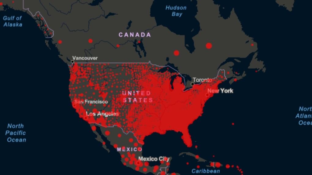
This map shows why it would be 'terrifying' to open Canada-U.S. border
By
Sean Davidson
Published:
This photo shows COVID-19 cases in Canada and the United States. The data on the map above is on a more localized level in the United States, which makes it appear more red, but there are an overwhelming number of cases south of the border compared to Canada. (Source: Johns Hopkins University)