Images captured by satellite show that the damage left in the wake of some of Canada's worst wildfires.
Red-brown burn scars are clearly visible in the images provided to CTVNews.ca by the Canadian Space Agency in late September.
These "before" and "after" images were captured by the Sentinel-2 satellite, part of the European Union's Copernicus Program, and by the U.S. Geological Society's Landsat 8, as they travelled over British Columbia, Yukon and the Northwest Territories.
The "before" images show the areas as they were seen earlier in the summer: green from trees, grass and other plants. Photos captured when the satellite passed by later in the season and into the fall show burn scars, where the earth was scorched and plants burned.
Thousands of people were evacuated from their homes during what has been one of Canada's worst wildfire seasons to date. The scope of the fires made international news as smoke drifted past the country's borders, floating as far as Europe in some cases.
The Canadian Interagency Forest Fire Centre estimates that 6,474 fires have burned up approximately 18.1 million hectares of land this year – 181,000 square kilometres, or the equivalent of about 17 million CFL football fields.
The below images show some of the larger fires reported in Canada this year. The satellite images were processed by Dromadaire Geo-Innovations.
YUKON – OLD CROW
These images of the remote Old Crow area of Yukon were captured on July 10 and Sept. 13. A state of emergency was issued for Mayo, Yukon, and the surrounding area including Old Crow on Aug. 8.
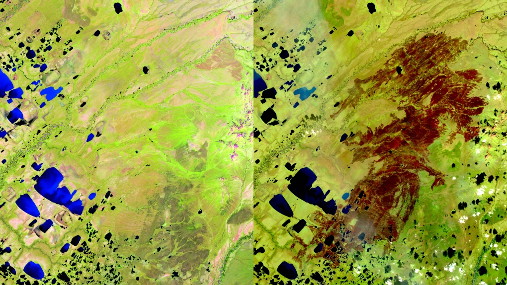 Image credit: Canadian Space Agency, contains Copernicus Sentinel satellite data (2023) processed by Dromadaire Geo-Innovations.
The photos show the natural colour, as seen from orbit.
The images below were captured through use of radar technology, and show the same area on July 7, compared to Sept. 1.
 Image credit: Canadian Space Agency, contains Copernicus Sentinel satellite data (2023) processed by Dromadaire Geo-Innovations.
NORTHWEST TERRITORIES – YELLOWKNIFE
These satellite images show the damage caused by fires in the Yellowknife area. The first was captured by the Copernicus Sentinel satellite on July 9. The second image shows the area as it appeared when the satellite passed by two months later, on Sept. 7.
 Image credit: Canadian Space Agency, contains Copernicus Sentinel satellite data (2023) processed by Dromadaire Geo-Innovations.
Images below were captured through with radar technology, and show the same area on July 6, compared to Sept. 16
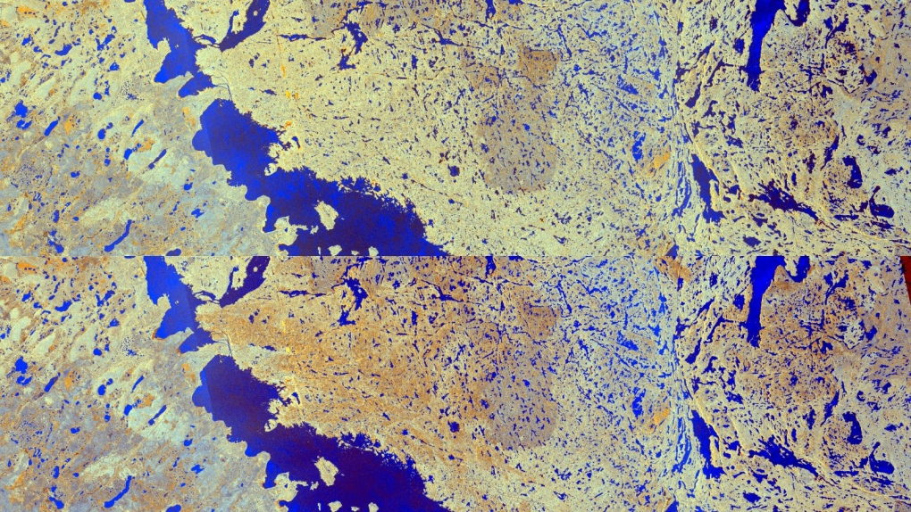 Image credit: Canadian Space Agency, contains Copernicus Sentinel satellite data (2023) processed by Dromadaire Geo-Innovations.
NORTHWEST TERRITORIES – HAY RIVER AND ENTERPRISE
These sensor images captured by the Sentinel-2 show the areas of Hay River (first) and Enterprise, N.W.T., both of which were the sites of evacuations earlier this summer due to fires.
The first image of Hay River was captured on May 2, and is compared to a shot of the same area four months later.
 Image credit: Canadian Space Agency, contains Copernicus Sentinel satellite data (2023) processed by Dromadaire Geo-Innovations.
The Enterprise images were captured on Aug. 8 and Aug. 23, showing what a difference just two weeks can make.
Image credit: Canadian Space Agency, contains Copernicus Sentinel satellite data (2023) processed by Dromadaire Geo-Innovations.
The Canadian Space Agency also included images captured with natural colour and shortwave infrared of the South Slave Lake region of the territory. These, captured on Aug. 28, show the smoke was significant enough to be visible from space.
 Image credit: Canadian Space Agency, contains Copernicus Sentinel satellite data.
Parts of this area were evacuated as far back as May, with further evacuations rolling out through the summer. Firefighters are still today dealing with hot spots in some parts of the South Slave region, including in Enterprise, and in Fort Smith, where the fire danger forecast was high to extreme for the weekend.