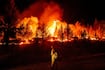
An update by British Columbia’s wildfire service says trace amounts of rain helped dampen part of a fire that has destroyed homes in the south Cariboo region, but it wasn’t enough to make a dent in the persistent drought wracking the area. The service says the short-lived rain on the northern flank of the Pear Lake blaze helped prevent the extreme fire behaviour that could have resulted from strong winds on Tuesday, but the drought has left forest fuels highly susceptible to ignition. The province’s drought map shows the south Cariboo — where the fire destroyed homes in the Clinton, B.C., area last week — is at level four on a scale of five. The Similkameen, Okanagan and Kettle River basins are also sitting at level four, while the Upper Nicola River shows a high risk of water scarcity. The B.C. government announced an order affecting more than 450 water licenses to protect fish in the Salmon River watershed on Tuesday, saying a severe drought has been plaguing the Thompson-Okanagan region and the river has shown persistently low streamflow despite significant voluntary conservation efforts. Other parts of southern B.C. are classified as drought level three, including eastern Vancouver Island, the Lower Mainland and the Sea to Sky region, as well as the Clearwater and lower and south Thompson basins. This report by The Canadian Press was first published July 29, 2026.