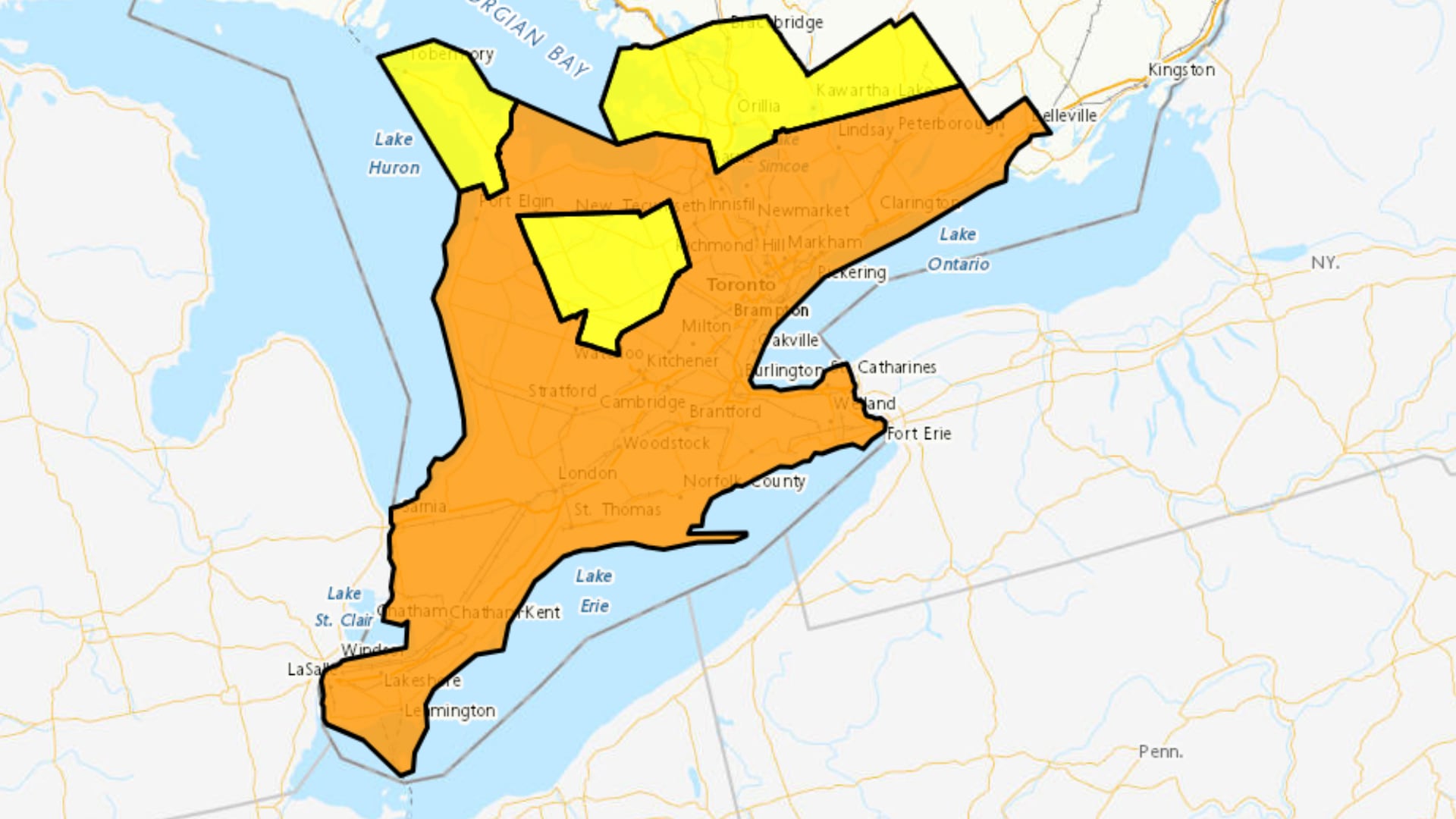
An orange heat warning, cautioning of a long-duration heat event, continues for much of southern Ontario. The warning stretches from Windsor-Essex, through Sarnia and Lambton County, London, Middlesex, Perth, Huron and all the way through the GTA, up to Peterborough. Environment Canada says maximum temperatures of 31 to 34 degrees C, and potentially up to 37 C are possible for some areas, with minimum temperatures of 21 to 25 C. The warning is expected to continue through Friday and possibly into the weekend with the hottest days expected through Thursday, with maximum temperatures of 34 to 37 C. The agency said minimum temperatures of 21 to 25 C will provide little relief from the heat. Hot and humid air can also bring deteriorating air quality and can result in the Air Quality Health Index approaching the high-risk category. Residents are reminded to take action to protect themselves and others, and to check on older adults, those living alone and other at-risk people in-person or on the phone multiple times a day. Here’s a look at the extended forecast Tuesday: A mix of sun and cloud. 40 per cent chance of showers early this morning with risk of a thunderstorm. Wind becoming southwest 20 km/h gusting to 40 this morning. High 35. Humidex 45. UV index 10 or very high. Tuesday Night: Clear. Low 24. Wednesday: Sunny in the morning and early in the afternoon then a mix of sun and cloud with 40 per cent chance of showers in the afternoon. Risk of a thunderstorm in the afternoon. Wind becoming west 20 km/h in the morning. High 37. Humidex 45. UV index 10 or very high. Thursday: Sunny. High 36. Friday: A mix of sun and cloud with 40 per cent chance of showers. High 35. Saturday: A mix of sun and cloud. High 33. Sunday: A mix of sun and cloud with 30 per cent chance of showers. High 30.