MEXICO CITY -- One of two storms off Mexico's Pacific coast strengthened into a hurricane Monday afternoon, while forecasters said the other was no longer expected to gain hurricane strength and neither posed an immediate threat to land.
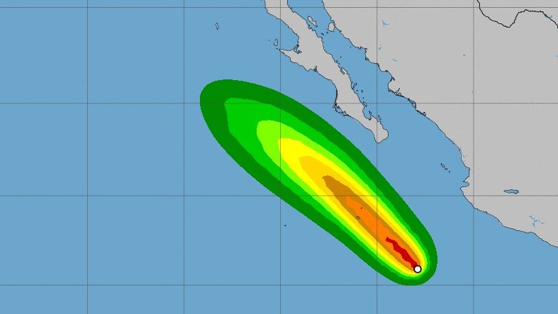
Hurricane John was centred about 320 miles (515 kilometres) southwest of the Mexican port of Manzanillo, with maximum sustained winds of 75 mph (120 kph) late in the afternoon. It was moving northwest at 8 mph (13 kph).
John was expected to strengthen rapidly and become a major hurricane by late Tuesday. It was forecast to peak as a Category 3 hurricane before starting to weaken while staying to the west of the Baja California Peninsula during the week.
Tropical Storm Ileana had been projected to reach hurricane force while marching northwestward parallel to Mexico's southwestern coast, bringing heavy surf, but forecasters said the storm was no longer expected to strengthen and should dissipate by late Tuesday because of the effects of the larger Hurricane John.
Ileana was closer to shore, centred about 155 miles (245 kilometres) south-southeast of Manzanillo. It had maximum sustained winds of 65 mph (100 kph) and was heading northwest at 17 mph (28 kph). Mexican officials discontinued a hurricane watch from Punta San Telmo in Michoacan state to Playa Perula in Jalisco state, though Ileana still could cause heavy surf and rains in that area.
Far out to sea, a strengthening Hurricane Hector was in the central Pacific as a strong Category 4 storm, with winds of 155 mph (250 kph), the Center Pacific Hurricane Center in Honolulu reported. It was centred about 850 miles (1,365 kilometres) east-southeast of Hilo, Hawaii, and was moving west at 16 mph (26 kph).
Hector also posed no immediate threat to land, but forecasters said people in Hawaii should monitor the storm's progress as it was projected to pass just south of the islands by midweek.


