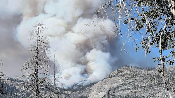
Wildfire activity is intensifying on Vancouver Island, with five fires listed as out of control by the B.C. Wildfire Service, including a Leech River-area blaze that is 35 hectares with further growth expected. The fire was discovered Sunday and is burning about four kilometres west of Sooke River, south of Mount Jack, near the Sooke Potholes. Plumes of smoke from the fire are visible from parts of the Sooke area. Erika Berg, a fire information officer with the Coastal Fire Centre, said multiple crews are responding, with support from helicopters, air tankers and other aviation resources. “It’s a dynamic situation,” Berg said. “It’s likely that folks in the area will see activity from firefighting aircraft,” she said. The increased activity comes after several new fires were reported across Vancouver Island over the weekend. “We’ve had a handful of new starts over the weekend on Vancouver Island, in particular,” Berg said. “The fuel conditions paired with this warm and dry weather that we have had is fuelling the activity that we’re seeing on Vancouver Island,” she said. The warm and dry conditions are expected to persist until at least Tuesday, Berg said, with cooler and wetter weather expected later in the week. The cause of the Leech River fire is suspected to be human. Another fire near Nitinat Main was discovered Saturday and has also grown to 12 hectares. The suspected cause is human, and helicopters are assisting firefighters. A third fire near Thistle Mine Road was discovered Sunday and has grown to about five hectares. The B.C. Wildfire Service says it is suspected to be human-caused, with aviation crews assisting ground crews. The fourth fire, at Pat Phillip Creek, is estimated at 0.3 hectares. It was discovered Sunday, and aircraft have been deployed to assist ground crews. The fifth fire is located in Rogers Creek and is 0.1 hectares. The fire is human caused and was discovered Monday, crews are currently responding. As of Monday afternoon, none of the five fires were threatening structures, and there were no area restrictions associated with the fires. Fire size and status can change quickly as crews assess conditions and work to contain the flames. Residents are encouraged to check the B.C. Wildfire Service incident map for the latest information on individual fires, including changes in size, status and potential impacts.