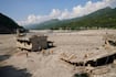
Just days after Saskatchewan’s Water Security Agency (WSA) warned of the potential for “high flow” amid the rapid snowmelt – communities across the province’s centre are contending with flooding. The advisory, issued on Friday, April 18, covered a large area from Buffalo Narrows in the northwest to southeastern areas around Yorkton. During an update Thursday afternoon, the Saskatchewan Public Safety Agency (SPSA) confirmed it is assisting both the Rural Municipality (RM) of Meadow Lake and Beardy’s and Okemasis’ Cree Nation as they deal with local flooding. The RM declared a local state of emergency on Tuesday and has received 40,000 sandbags, two sandbagger machines, pumps and hoses from the SPSA – in addition to personnel. The agency also provided sandbags and a sandbagger to Beardies and Okemasis’ on Wednesday. The SPSA says other communities have received steamer units to help clear frozen culverts and reduce the risk of road washouts. “There [are] still significant flows in the Meadow Lake area, and as I said, in the forested areas, there is still a fair bit of snowpack, but it is something that we’ll be watching,” WSA President Shawn Jaques explained. Jaques added forecasted cooler temperatures over the next week are expected to help stabilize, rather than increase flood risk. Speaking more generally about the high flow alert, Jaques said the WSA forecasts that the province has already experienced peak flows in most of the water systems impacting communities. “There’s still some areas of concern in the northern end of the Saskatchewan River Basin and in that northwest part of our province,” he added. As of 12 p.m. Thursday, 12 roads across the province were reporting flooding, leading to several closures. Several communities took to social media earlier in the week to report the effects of the rapid snowmelt. On Wednesday, the Rural Municipality (RM) of Fish Creek reported that a major route was washed out in its area – while residents in the town of Foam Lake were forced to fill sandbags as the community’s creek flowed beyond its banks. According to the Highway Hotline, in the area of the RM of Fish Creek, Highways 2, 3, 20, 25 and 320 have been place under advisories as water has been reported on those routes. Near Foam Lake, Highway 310 has been closed both north and south of Highway 16 thanks to elevated water levels. The flooding comes as much of northern and central Saskatchewan is slated to be hit by a late spring storm that could dump up to 50 centimetres of snow in certain regions. According to Environment Canada, the effects of the storm are expected to last until the weekend. The recent snowfall has aided some of Saskatchewan’s driest regions such as the southwest, while adding onto areas that have been well saturated in terms of precipitation. “That snowfall of about a week ago, some of the driest parts of our province, you know, got 20-30, centimeters of snow, which is very welcome for soil moisture,” Jaques added. “[For the] central part of the province, we’re seeing good moisture. The north is well above and part on the eastern side, from Hudson Bay down to Yorkton, is going to be well above runoff.”