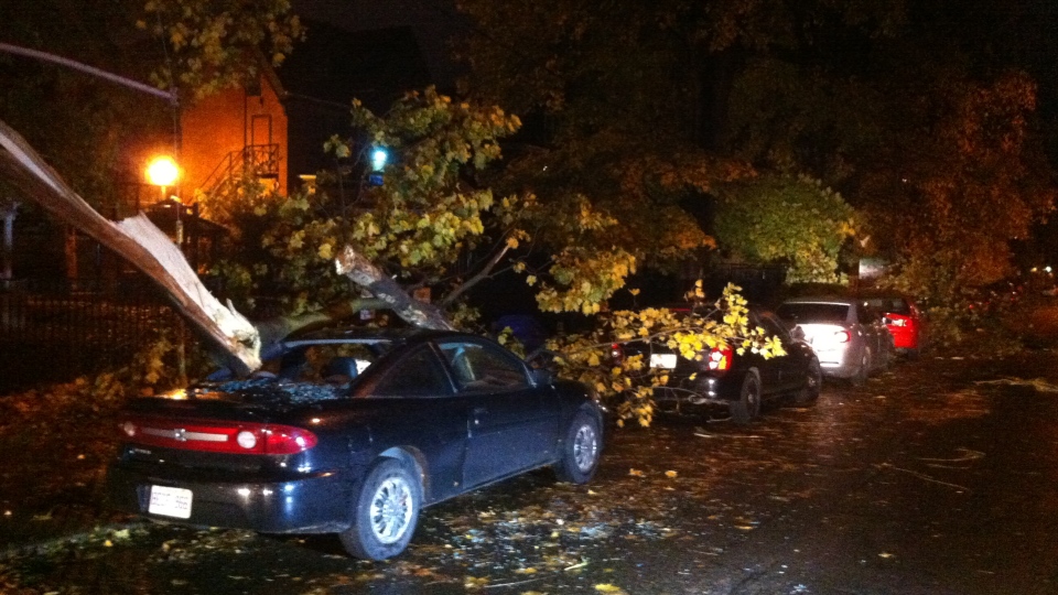
A woman in Toronto was killed Monday night after high winds kicked up by a monstrous storm in the U.S. sent debris from a store sign falling on top of her.
The remnants of what has now become post-tropical cyclone Sandy moved into southern Quebec and Ontario Monday evening, bringing with it not only high winds, but also heavy rains and power outages.
The storm is also on track to pass over parts of Nova Scotia and New Brunswick on Tuesday.
The woman was outside a Staples store in Toronto’s west end when she was hit by the debris. Wind gusts at the time were clocked at 65 km/h.
Meanwhile, multiple power outages were reported in the Greater Toronto Area, as well as other parts of southwestern Ontario and Quebec.
Ontario Energy Minister Chris Bentley announced late Monday that nearly 66,900 customers in the province were without power. However, that figure jumped to more than 130,000 early Tuesday morning.
“Trained crews of professionals are onsite across Ontario and working to restore power safely and as quickly as possible,” Bentley said in a statement. “We will provide updates on power restoration as soon as they become available."
In Quebec, about 34,000 people were without power, reported CTV Montreal’s Kevin Gallagher.
What to expect as storm moves through Canada:
• In Ontario:
Environment Canada predicts between 20 and 40 millimetres of rain in southern Ontario and strong winds into Tuesday. Wind gusts could reach up to 100 km/h, especially along western Lake Ontario, the Niagara Escarpment and areas near Georgian Bay and Lake Huron.
Heavy bands of rain were expected Monday overnight, but rainfall amounts will vary greatly depending on location. The rain could turn into snow in some parts of Ontario as temperatures approach the freezing mark.
Large waves are expected in portions of the Great Lakes, especially on Southern Lake Huron.
• In Quebec:
Periods of heavy rain started Monday evening, with up to 40 millimetres expected in some areas. In Western Quebec, the rain could turn to snow. Wind warnings have been issued for the St. Lawrence Valley area and nearby regions, where wind gusts were predicted to exceed 90 km/h. Storm surge warnings have also been issued along the north shore of the St. Lawrence River.
• In the Maritimes:
Rain is not expected to reach the southwestern Maritimes until Tuesday morning and it could persist until Wednesday, with total amount of rainfall exceeding 50 millimetres.
Strong winds battered Nova Scotia Monday night and were expected to increase to 80 km/h overnight. Waves along Nova Scotia’s south shore were expected to reach seven metres Monday night, possibly causing some local flooding.
Storm surge hits U.S. coastline
The storm has the potential to cause havoc over more than 1,280 kilometres from the East Coast to the Great Lakes and endanger up to 50 million people.
The centre of the storm made landfall around 8 p.m. ET in New Jersey. By early Tuesday morning, the storm was being blamed for 13 deaths in five states.
President Barack Obama declared emergencies in Massachusetts, Connecticut, Rhode Island, New York, New Jersey and Pennsylvania, authorizing federal relief work to begin well ahead of time.
Sandy was blamed for 65 deaths in the Caribbean before it began travelling northward, parallel to the Eastern Seaboard.
Bob Robichaud of the Canadian Hurricane Centre said while Sandy struck late in hurricane season, there could be more Atlantic storms to come.
“Hurricane season ends Nov. 30 and there have been tropical cyclones and hurricanes pretty much every month of the year. So even though this is a late storm, the season is not over until for another month so we have to be prepared for them.”


