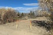
The Ottawa Fire Services (OFS) used GPS coordinates from a man’s cellphone to locate him after he was trapped waist-deep in mud in Orléans Tuesday morning. First responders were called to a trail north of François Dupont Park around 10:45 a.m. Tuesday. The man called 9-1-1 to say he was buried up to his waist in thick mud after walking into a bog and couldn’t move. There was nothing around him to hold onto or pull himself up with. “In this situation, we were very lucky that this caller had a cell phone that we could map where he was exactly. There were no landmarks around, no buildings, nothing to pinpoint exactly where he was,” said OFS dispatcher Kimberly Mountain. “Most of the time you can get a very good location as to where the callers are. It triangulates with the cell phone towers and for this particular caller, we had a very small location of where he was in the middle of the forest in the middle of mud. After retrieving the man’s GPS coordinates using data from nearby cell towers, dispatchers sent the location information to a tablet firefighters keep with them. “For some people, it can be difficult to describe exactly where they are, so this gives us an opportunity to leverage technology to our advantage and gives us one more tool in the toolbox to be able to locate somebody,” said acting OFS Capt. Evan Carter. Firefighters used specialized equipment and ropes to get the man out. He was assessed at the scene and released. “Our dispatchers went above and beyond at this call like they do for every call, not only finding his location quickly for the firefighters to get to him, but also stayed on the line with him the entire time to keep him calm,” said OFS public information officer Nick DeFazio. “They even went as far as to call his wife, who was at a physio appointment expecting him to pick her up, let her know what was happening. Reassured her that we were going to rescue him and that everything was okay.” With files from CTV News Ottawa’s Ted Raymond