
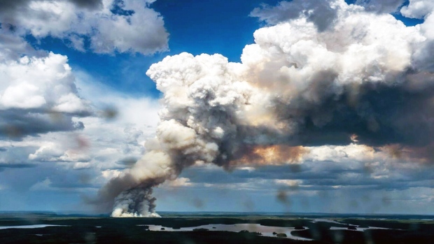
The number of people forced to evacuate their homes is expected to rise as wildfires continue to burn across northern Saskatchewan.
The wind continued to stoke the flames on Thursday, prompting Environment Canada to issue an air quality alert for parts of both Saskatchewan and Manitoba.
The federal agency says residents should be aware of possible health concerns, including shortness of breath, and irritated eyes and throats.
In neighbouring Manitoba, incoming thick smoke could result in poor air quality and reduced visibility, Environment Canada warned.
More than 5,000 people in 51 different communities have been evacuated from their homes since the wildfires began last month.
“It’s a significant challenge, not only with the number of fires – which is well above the average – but also the location of the fires,” said Duane McKay, Saskatchewan’s emergency management and fire safety commissioner, at a news conference on Thursday.
“A lot of those fires are in and around communities, which is causing a significant risk to those communities and is a significant priority for us to deal with.”
Despite health concerns, the smoke is also helping in some ways. Smoke keeps the temperatures lower and boosts humidity, which in turn keeps the raging blazes slightly less volatile and more contained.
There are currently 110 active fires in Saskatchewan, the province says, of which 49 are greater than 100 hectares in size.
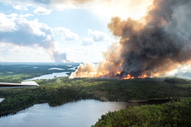
“Most of these fires were started as a result of a weather cell that went through, causing a lot of lightning strikes,” McKay said. “In one 24-hour period we had over 44 fires start.”
Nearly 600 firefighters, 40 helicopters and 19 planes are battling the blazes. Ontario, Quebec, Newfoundland and South Dakota have sent crews to help fight the fires.

Canadian Red Cross Saskatchewan director Cindy Fuchs said evacuating people from their homes has been a huge undertaking.
“It’s the biggest that I’ve seen in my career at Red Cross,” Fuchs told reporters. “This is really complex.”
An evacuation centre set up in Prince Albert is now full, so displaced residents are being sent to Regina and Saskatoon.
Officials say more shelters will be opened as the need grows.
You can get an idea of the Western Canada “smoke forecast” at firesmoke.ca, but it’s considered experimental because it’s “subject to uncertainties in weather forecasts." Just click on the image below.

The scale on the map is measured in micrograms of fine particulate matter per metre cubed. Locations on the map are approximate.


