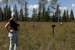
If you’re driving to La Barriere Park, expect a major barrier on the road. That’s because the bridge over the La Salle River is now completely under water. Meredith Greenall, who has lived close to the river for 15 years, said it can sometimes swell so high around this time of year, you can’t even see the railings. “I used to take the school bus to school when I was in high school and elementary school, and it would have to come around because the bridge is flooded for sometimes months on end,” she said in an interview with CTV News on Tuesday. The La Salle isn’t the only river in the city to rise recently. The Red River has jumped up 2.75 feet from levels recorded a week ago. The city said levels have gone up recently because of ice jams in the south and west parts of the city. As jams let go and send a surge of water, Winnipeg is seeing a quick rise at the James gauge. “We’re a city that has to watch flooding,” said Coun. Sherri Rollins (Fort Rouge-East Fort Garry). “We are in one of the largest basins that you’ve got here in North America. So, this is a reality. We live by a river. Rivers change.” Rollins noted because of that long history with flooding, the city’s emergency management department will be ready for this flood season. “Our emergency management office is equal to the task…Whereas other cities are doing [simulations]. It’s our reality,” she said. The city said crews have activated flood pump stations, sealed manholes and have been inspecting and closing river gates. In its Tuesday flood bulletin, the province said it may activate the Red River Floodway as soon as this weekend to control water levels in the city. The bulletin noted that current warmer temperatures are creating an increased flood risk in the Interlake and Parkland regions. However, flood risk remains moderate to low in other parts of the province. The province said that snow water content in some areas, including the Parkland and Interlake regions, is normal to above normal, adding that an upcoming precipitation system is expected to impact central and northern Manitoba. “Temperatures are forecasted to fall below-freezing levels from Thursday to Sunday, slowing the snowmelt rate,” the bulletin said. “However, temperatures are forecasted to return to seasonal normals of above-zero degrees starting early next week (April 20) and increasing the potential for a rapid, concentrated spring runoff period once melting begins.” More information on Manitoba’s flood outlook is available online.