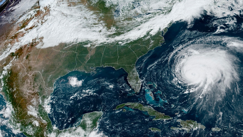
Newfoundland and Labrador is bracing for heavy rain -- and even snow in some parts -- as Hurricane Fiona barrels towards Atlantic Canada.
As of Thursday afternoon, Environment Canada has issued tropical storm or hurricane alerts for 27 communities in the province.
On the peripheries of the storm in western Labrador, potential snow is in the forecast Saturday and Sunday night in communities like Churchill Falls and Labrador City.
Fiona is expected to make landfall in Canada on Saturday morning on or around Cape Breton Island in Nova Scotia as it heads north-northeast. It's expected to be a Category 2 hurricane, with sustained winds up to 215 kilometres per hour.
"You can see that it's a very tightly clustered storm making landfall in eastern Nova Scotia, either eastern mainland Nova Scotia or Cape Breton before moving into the Gulf of St. Lawrence and affecting parts of eastern Quebec and Newfoundland as well," said Bob Robichaud of the Canadian Hurricane Centre in a press briefing on Thursday.
By Saturday, Fiona will head towards the western part of Newfoundland and at this point, Fiona is expected to be a "post-tropical storm."
"That does not mean a weaker storm. That just means that the structure of the storm is different than a pure tropical system but it will act both tropical and non-tropical characteristics when it reaches us," Robichaud explained.
Fiona is expected to continue on its northward track and reach Labrador by Sunday, bringing heavy rainfall. Environment Canada warns that rain upwards of 200 millimetres by Sunday morning can be expected in southwestern Newfoundland and eastern Nova Scotia.
"Some districts have received large quantities of rain recently, and excessive runoff may exacerbate the flooding potential. Road washouts and erosion are also possible," the agency says in its weather statement.
Correction:
Updated to say Fiona is expected to hit on or around Capt Breton Island on Saturday morning,

