
HALIFAX -- The Canadian Hurricane Centre says it is monitoring hurricane Joaquin, which may move into Canadian waters early next week.
The storm is battering the central Bahamas with torrential rains that flooded homes and forecasters warned that the "extremely dangerous" Category 4 storm could grow even stronger as it roared along a path that could take it near the U.S. east coast.
The Halifax-based Canadian Hurricane Centre says there's a high degree of uncertainty around the storm's track forecast.
It says there are two particular scenarios, one that would have it moving into the Carolinas and the other showing it far offshore from Atlantic Canada.
The latest trends from computer models lean toward it being an offshore system with little impact over land.
If it does move into the Carolinas, the centre says that could lead to rainfall in southern Ontario, Quebec and Atlantic Canada.
It says the saturation of the ground after heavy rainfall this week means there is a risk of flooding if it does track across land.
"Once again, the threat of that situation appears to be decreasing but still has to be considered," the centre says in a statement.
The centre says it expects to have a better indication whether the storm is going to be a concern over land on Friday afternoon.
"The hurricane is compact (small) which often means that the intensity will fluctuate significantly even over the span of 24 hours."
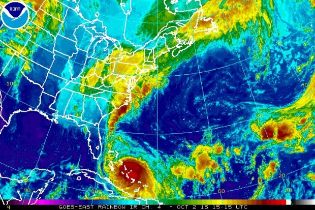
Hurricane Joaquin is seen in this enhanced NOAA image taken at 11:15 a.m. ET, Friday, Oct. 2, 2015.
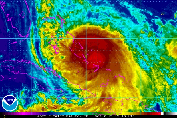
Hurricane Joaquin is seen in this enhanced NOAA image taken at 11:15 a.m. ET, Friday, Oct. 2, 2015.
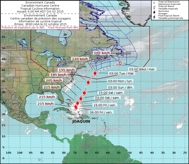
Track map from the Canadian Hurricane Centre shows the projected path of Hurricane Joaquin.
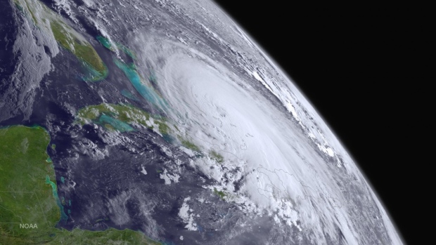
NASA satellite image shows Hurricane Joaquin, Thursday, Oct. 1, 2015.


