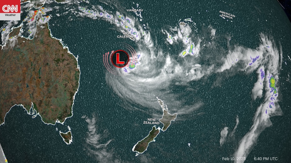
New Zealand is bracing for its most intense tropical cyclone since the 1990s. Tropical Cyclone Gabrielle is heading toward the North Island just two weeks after the area was hit with record flooding.
On January 27th, 240 mm (9.44 inches) of rain fell in Auckland, the country's largest city. That marked the most rainfall the city had ever seen in a day, and it was the equivalent of their entire summer's worth of rain.
Now, a new threat is set to bring ferocious winds and devastating rains to Auckland and the North Island.
The New Zealand MetService is forecasting that Tropical Cyclone Gabrielle is likely to impact the northern parts of New Zealand on Sunday and continue through Tuesday.
"Those areas that are already vulnerable following last week's weather are expected to see more rain, strong wind, heavy swells and coastal inundation which will exacerbate the situation," said Lisa Murray, Head of Weather Communication at MetService. "If the cyclone continues on its current path towards the north of Aotearoa New Zealand, we can expect this to be an extreme weather event with widespread damage."
Gabrielle is currently the equivalent of a Category 1 hurricane with winds of 140 kph (85 mph) as it churns over the Coral Sea, a few hundred kilometers off the Queensland coast of Australia. While it will likely weaken a little more before making landfall, the mountanous terrain can rapidly increase wind speeds and rainfall.
"This is the most intense tropical storm that we've seen threaten the northern part of New Zealand since the 1990s," Philip Duncan, head forecaster at New Zealand-based Weather Watch, tells CNN.
While the storm may also lose its tropical characteristics and become a post-tropical system, it is not expected to lose its punch.
"We're expecting 100 to 300 mm [of rainfall] for many parts of the North Island's north and eastern sides, with even greater totals if Gabrielle stalls or slows down," Duncan said. "This rain will cause more slips/landslides, road closures, flight cancellations and possibly damage more homes as we saw in January."
Heavy rain watches have been issued for northern New Zealand starting on Sunday as Tropical Cyclone Gabrielle approaches with the threat of heavy rain and high wind gusts.
Another heavy rain watch has also been issued for the Coromandel Peninsula and for Gisborne, where rainfall totals of 200 mm to 400 mm or more are possible.
"The duration of the event and the amount of rain forecast is highly dependent on the track of Cyclone Gabrielle, and this Watch could be upgraded to an Orange or possibly Red warning in the coming days," warns the New Zealand MetService.
High wind watches have also been issued for most of the North Island of New Zealand.
Winds are likely to gust over 100 kph (62 mph) and could reach 150 kph (93 mph) in the higher terrain and along the immediate coastline. Conditions are expected to begin deteriorating Sunday and the worst of the storm should impact the country from Monday into Tuesday, local time.
"Don't forget a cyclone brings severe damaging wind as well as heavy rain and swell," Murray said. "As the ground is already sodden, trees are more likely to topple, which could cause power outages."
Along with wind and rain, there will also be heavy swells along the coastline for eastern areas and a storm surge of close to half a meter on top of that.
Tropical Cyclone Gita impacted the South Island in 2018, which was rare because of how far south it moved, according to Duncan. However, that storm only impacted around 100,000 to 150,000 people while Gabrielle poses a threat to around 2.5 million. Duncan says the last major cyclone event to affect northern New Zealand was during the 1996-97 cyclone season with Cyclones Fergus and Drena.


