
TORONTO -- Parts of southern British Columbia continue to deal with flooding, mudslides and rockslides after heavy rain hammered the province Sunday and Monday.
As a result, numerous highways have been blocked off, cutting off vital corridors between B.C.'s lower mainland.
Drive BC's highway webcams have captured images of some of the roads affected by the flooding.
 In Abbotsford, a city in the lower mainland located an hour's drive from Vancouver, a look at webcam images facing west on Cole Road at Highway 1 show the road all but completely submerged. The camera facing east shows Highway 1, as well as the entrances to the highway, covered with floodwater.
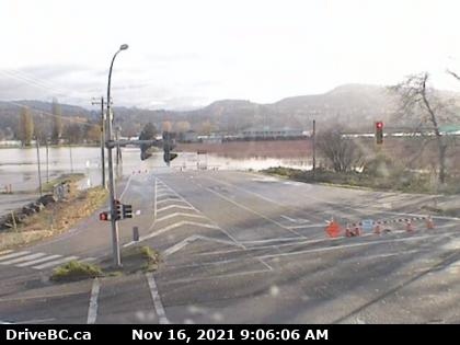
It's a similar story looking east on Clayburn Road in Abbotsford from Highway 11. The intersection connecting Clayburn Road has been blocked off, as the road is submerged.
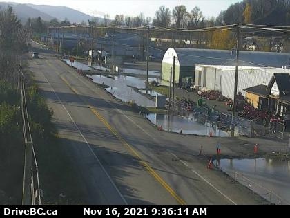
On Farmer Road in Abbotsford, near the border with Sumas, Wa., images show local businesses affected by flooding, although the road itself appears to be clear.

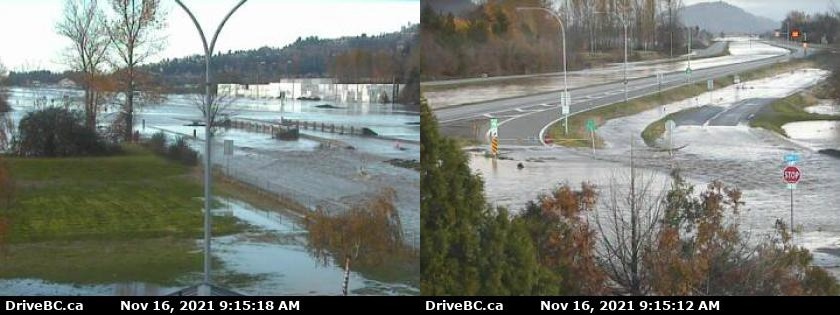
Meanwhile, in the city of Delta, B.C., webcams mounted on the intersection of Highway 99 and Highway 17A show floods affecting agricultural fields alongside the roads.
Nearly 20,000 B.C. residents remain without power. Given these outages, webcams for some of the hardest-hit areas along the Fraser Valley in B.C.'s interior are offline.
Communities in the interior, such as the entire city of Merritt, B.C., have seen evacuation orders affecting thousands. School districts in the interior and in the lower mainland have also cancelled classes for Tuesday.


