
Smoke from raging wildfires in Alberta now stretches across the country, creating hazy skies in several provinces.
About 20,000 people have been forced from their homes while about 90 wildfires burn in Alberta, 25 of them listed as out of control blazes as of Tuesday morning.
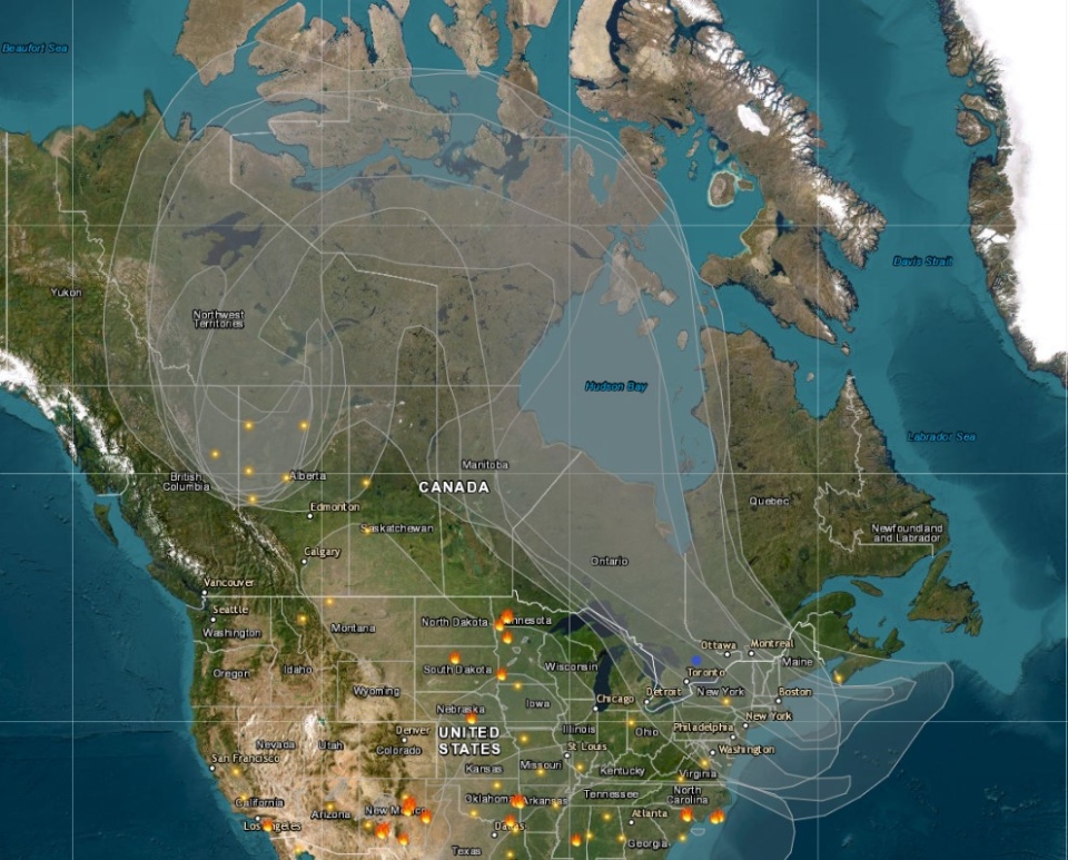
A real-time tracking map created by AirNow, which monitors wildfires and air quality in North America, shows the extent of the reach of smoke from the blazes.
The map shows how the smoke first travelled north into Yukon and Northwest Territories before heading east into Nunavut.
From there, the smoke headed south over portions of Manitoba and southeast Ontario and Quebec. The maps shows the thicker flow of the smoke reaching in the New England states and as far south as Virginia. Click here to view the live-tracking map in real-time.
On Monday, Environment and Climate Change Canada (ECCC) noted hazy skies in northern and eastern Ontario were a result of wildfire smoke, however, no air quality statements were issued in the province.
Air quality statements are in effect for large portions of Alberta, into Sask. and B.C. due to the wildfire smoke.
"Air quality and visibility due to wildfire smoke can fluctuate over short distances and can vary considerably from hour to hour," ECCC warned on Tuesday. "Wildfire smoke can be harmful to everyone’s health even at low concentrations."
Alberta’s provincial government declared a state of emergency on Saturday. Several provinces are assisting the wildfire fight by sending equipment and firefighters to Alberta.
Below is a map focused on Alberta showing satellite (VIIRS) thermal hotspots and fire activity, detected by VIIRS sensors on the NOAA/NASA Suomi NPP and NOAA-20 satellites during the last 7 days:
Click here to see a full-screen version of ESRI Canada's map


