It was the year of too much -- too wet, too dry, too hot, too cool.
"It wasn't a typical Canadian kind of year, where if you don't like the weather out your front door, look out your back door," says David Phillips, Environment Canada's chief climatologist.
Phillips has just released his list of Canada's Top 10 weather stories of 2017. If there is a common theme, it's one of normal weather becoming abnormal simply by not changing.
For example, last spring the rain in British Columbia just wouldn't stop. That was immediately followed by the province's driest summer ever.
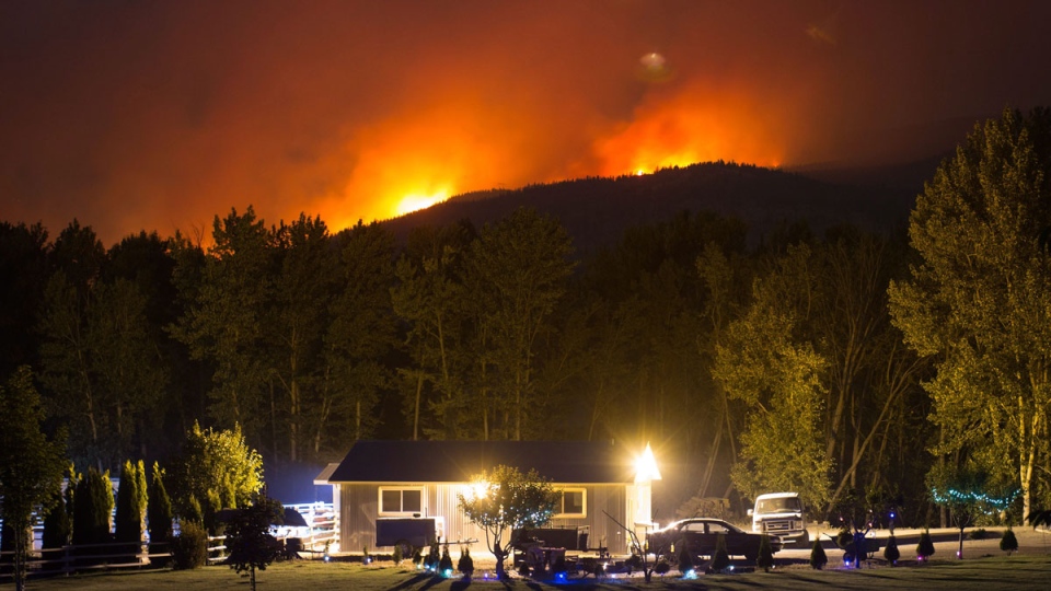
The result was the most disastrous fire season in B.C.'s history. Those fires, which forced 50,000 people from their homes, are Phillips's nod for top weather story of the year.
All across the country, weather patterns that would normally move on after a few days lasted and lasted.
A huge dome of hot temperatures sat over the Prairies for most of the summer. Calgary had its hottest May through August since 1881.
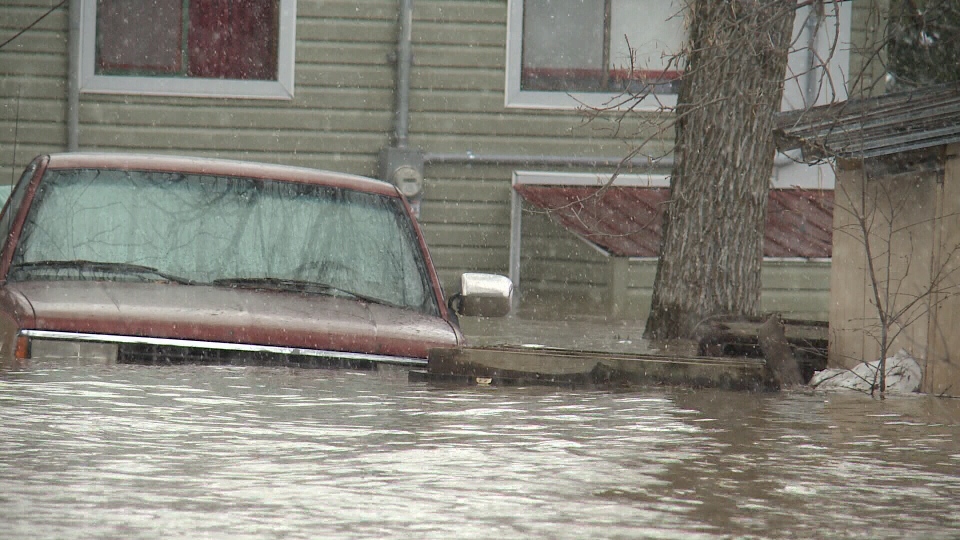
The central Canadian spring began with floods in Quebec and eastern Ontario after persistent rains saturated a snowpack only half melted. The Windsor area recorded two storms of the century in less than a year.
Ontarians are calling 2017 The Summer That Wasn't -- a cool, damp season of unrelenting disappointment. The province had more warm days after the official start of autumn than before.
Newfoundland was hit by a slow-moving blizzard that ravaged the island with winds of 190 kilometres an hour. It yanked trees from the ground, toppled traffic lights and blew off roofs as if they were dust specks.
Every part of the country, in every season, saw weather patterns that just wouldn't quit, for good or ill. For an explanation, Phillips looks to the jet stream, a high-altitude, high-speed current of air that helps produce what we've come to call normal.
It usually flows west to east in a more or less straight line from Victoria to St. John's, Nfld., cold air to the north and warm to the south. Last summer, it looped north of Tuktoyaktuk, N.W.T., then south of the Great Lakes, before heading back up to the Maritimes.
The so-called "loopy" jet stream tends to produce weather patterns that get stuck.
Emerging science suggests the unstable jet stream also may be linked to shrinking Arctic sea ice, says Phillips.
"I think it was a factor."
Phillips, like most scientists, stops short of blaming 2017 on climate change. But if it were climate change, 2017 is what it would be like.
"People think with climate change, it's all about warm, warm warm. But what you get is a shift in weather patterns, where you can actually end up with opposite of what you might think."
After a 22-year career in weather, Phillips says things have truly changed.
"I remember when I started my career, you'd get one season that was interesting. Now, every one has something to write about.
"The weather is changed. It has a different character, a different personality to it in its duration and intensity."
Here are his top 10 weather events of the year:
1. British Columbia's Longest and Most Destructive Wildfire Season
The province was forced to declare its longest-standing provincial emergency when 1,265 fires scorched 12,000 square kilometres of forest, bush and grassland. About 50,000 people were forced to flee. The fires came during the province's driest summer on record.
2. Dry and Hot in the West
Summer temperatures broke records -- Medicine Hat, Alta., recorded 34 days of plus-30 C weather -- and it was so dry that Regina was 22 per cent under its previous record for low rainfall. On the bright side, no rain meant no mosquitoes.
3. Spring Flooding in Quebec and Ontario
Montreal and Ottawa had their wettest springs in history. In May, rivers from Gananoque to Gaspesie flooded past historic maximum flows. More than 5,000 residences were swamped and 550 roads were washed out by floods or covered by landslides. Two people were swept away by the swollen Sainte-Anne River in the Gaspe region.
4. British Columbia's Cold and Snowy Winter
The West Coast was shivering through its second coldest winter in the last 25 years. It was distinguished by the duration, frequency and length of snowfall and snow on the ground. Skiing was good, but public golf courses were closed for up to two months -- the first such closures in 20 years.
5. Another Windsor flood
Two Storms of the Century in a Year.@ Less than a year after a record $153-million flood hit the Ontario city and surrounding area, another arrived on Aug. 28. In less than 48 hours, 222 mm of rain fell in southwest Windsor. Nearby LaSalle received 125 mm that day and another 160 mm the next. Curbs were piled high with waterlogged carpets, spoiled furniture, broken appliances and sodden belongings.
6. Central Canada's Missing Summer
Total rainfall from April to July around the Great Lakes and St. Lawrence River was the highest in 70 years. Cool temperatures, overcast skies and frequent spring showers hung around all summer. Farmers were weeks behind schedule. Lake Ontario reached an unprecedented 75.9 metres above sea level in May. The Toronto Islands were off limits from mid-May to the end of July.
7. A New Storm of the Century
A storm struck Ontario on March 13 before moving into Quebec and Atlantic Canada. It led to a multi-car pileup, in whiteout conditions, involving 15 transport trucks and other vehicles on Highway 401. The highway was closed as twisted metal littered the road and a toxic acid spill polluted the air. The storm then dumped 50 centimetres of snow at more than half the reporting stations in southern Quebec. No previous storm eclipsed so many snowfall records. The storm killed five people.
8. Summer in September
The first day of fall marked Central Canada's warmest weather. From Sept. 22 to Sept. 27, more than 1,000 heat records tumbled as humidex values shot up close to or above 40, prompting a week-long stretch of heat warnings. Southern Quebec had its warmest October since at least 1870.
9. Newfoundland's Brier Blast
Hurricane-force winds ravaged Newfoundland on March 1 and 2, but it was the "Brier blast" on March 11 that saw winds on the Avalon Peninsula peak at Bay de Verde at a hurricane-force of 190 km/h. Some 70,000 residents and visitors were left in the dark, trees were uprooted, traffic lights and power lines toppled, and the second-storey of some homes ripped off.
10. New Brunswick's Glaze Storm
A long-lasting mix of rain, snow, freezing rain and ice pellets over Quebec and Atlantic Canada in late January killed two and injured dozens. Nearly 300,000 residents were left in the dark and cold after power lines snapped. Some communities were without electricity for up to 12 days. Canadian troops were deployed to help with the ongoing emergency response.

