

Photos taken above Fort McMurray four days apart tell two very different stories.
These satellite images taken by Google subsidiary Terra Bella give a bird’s-eye view of the northern Alberta community on May 1 – before fires had reached the city -- and May 5.
View Google’s map here, or scroll down to see “before” and “after” comparison images of some of Fort McMurray’s most damaged neighbourhoods.
Instructions: On desktop, hover to toggle between "before" and "after" images. On mobile, tap an image to reveal the "after" photo, tap outside the image to return.
Waterways (May 1 and May 5, 2016)
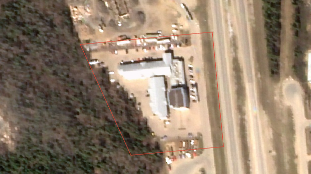
Super 8 Hotel (May 1 and May 5, 2016)
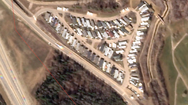
Centennial Trailer Park (May 1 and May 5, 2016)

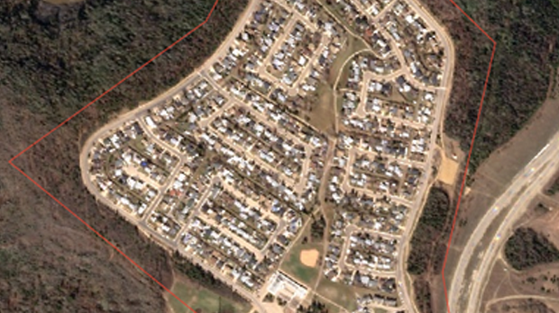
Beacon Hill (May 1 and May 5, 2016)
Abasand (May 1 and May 5, 2016)

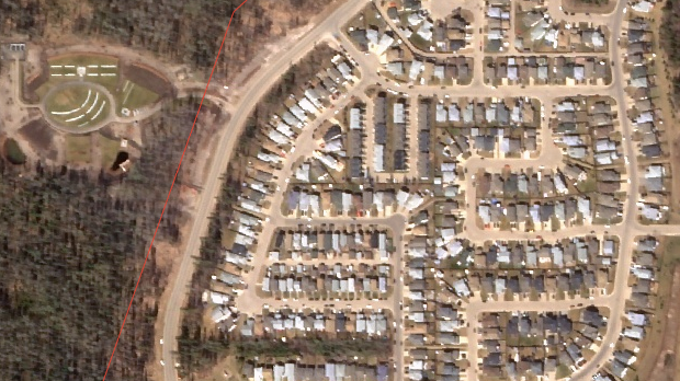
Wood Buffalo (May 1 and May 5, 2016)
See the full Google map below (click the "Layers" tab and scroll to the bottom to toggle satellite images for different days).


