From wildfires consuming tens of thousands of acres across Europe, to millions of acres ravaged in Argentina’s Corrientes province in February, and hundreds of wildfires now burning across Canada, 2022 has seen plenty of extreme fire events fuelled by heat waves and droughts that scientists say have become more frequent.
“Not only does it seem like these fires are getting larger, more deadly, and more frequent, it seems like they're becoming more common across the globe,” says Dan Pisut, Environment and Climate Resilience Lead with digital mapping company Esri, in a story map titled “Discovering Patterns in Global Wildfires.”
Wildfires can be sparked by a number of sources, including naturally via lightning strikes or simply by heat from the sun, but experts say most are caused by humans. Alberta wildlife information officer Melissa Story previously said 67 per cent of wildfires in 2021 were caused by humans.
The effects of climate change increase wildfires, due to hotter summers and less rainfall in some areas. “Drought-induced wildfires will also become more common and more severe,” says Esri.
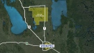
In the map below, using satellite data from NASA made available in real-time from Canada and the U.S. -- and within three hours of observation in the rest of the planet -- digital mapping company Esri gives a global view of active wildfires.
See the map provided by ESRI Canada in full screen
Information about the map