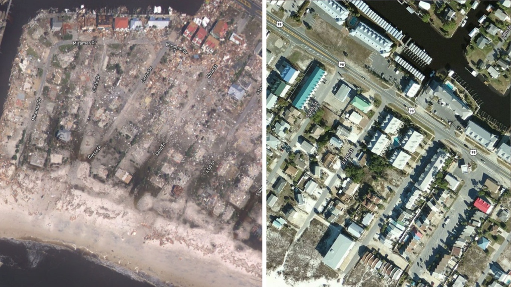
Satellite images released by the National Oceanic and Atmospheric Administration on Thursday gave a stark look at the extent of the destruction left by Hurricane Michael.
The images, taken October 11, offer a look at one of the hardest hit areas, Mexico Beach, Fla., before and after the hurricane touched down, with much of the town seemingly wiped off the map.
The images show houses destroyed, trees ripped from the ground, and debris scattered by the Category 4 hurricane’s 250 kilometre-an-hour winds and three-metre storm surge.
In some areas, entire subdivisions were almost entirely wiped out, with just a few buildings left standing.
If you're reading this on an app, tap here to see the interactive sliders

