With greenhouse gas emissions usually reported at the global or national level, it can be difficult to determine their prevalence in local communities.
Until now, that is.
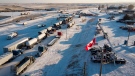
A new tool developed by scientists at the Johns Hopkins Applied Physics Laboratory tracks the spread of greenhouse gases such as carbon dioxide at the scale of a city block.
Using artificial intelligence and satellite imaging, researchers are able to provide estimates of vehicle emission levels across 500 cities worldwide.
CTV News Science and Technology Specialist Dan Riskin has more in this month’s Riskin Report.