Eastern Canadian trick-or-treaters may have to fend off the remnants of the massive U.S. storm system as they go from house to house this Halloween, in the wake of a monstrous storm expected to wallop our eastern coast with wind, rain and even snow.
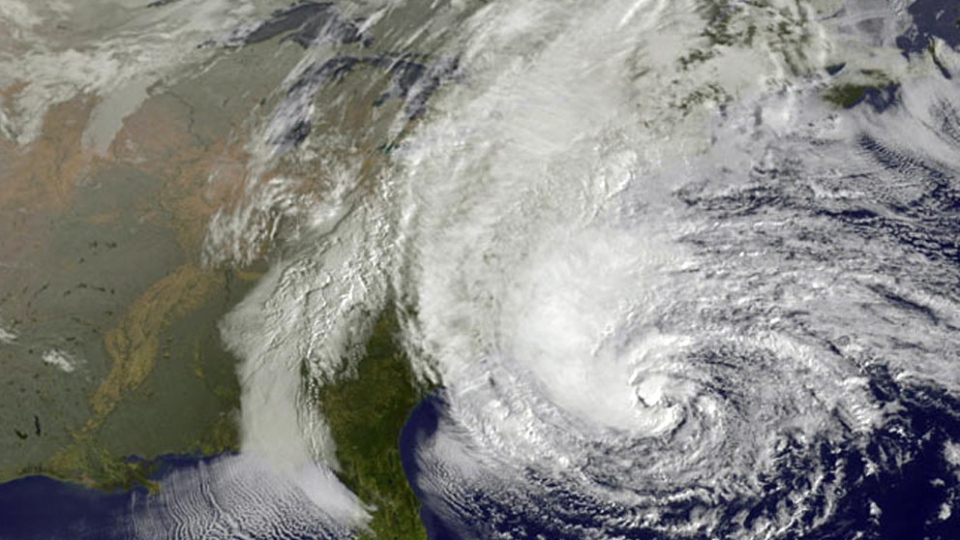
A tropical cyclone and a winter storm are expected to make a rare collision late Monday or early Tuesday over the densely populated areas of the U.S. East Coast, and effects will spill over into Quebec, southern Ontario and parts of the Maritimes.
The hybrid “superstorm” is expected to hit nearly 70 per cent of Canada, said CTV British Columbia meteorologist Michael Kuss.
It will cause high winds, heavy rain, extreme tides, the possibility of snow and perhaps extensive damage, said Bob Robichaud of the Canadian Hurricane Centre.
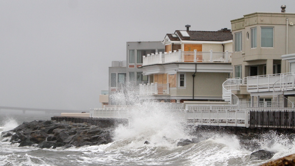
“With winds as strong as we’re talking, we’re going to see some significant coastal flooding, possibly some widespread power outages, heavy rains, that type of thing,” he told CTV News Channel Saturday.
The remnants of Hurricane Sandy -- which left at least 58 dead as it blew through the Caribbean this week -- are heading north and are on a collision course with a wintry storm moving across the U.S. from the west, along with cold air from Canada.
Forensic meteorologist Howard Altschule told CTV News Channel he expects the hurricane to touch down in either central or southern New Jersey between Longbeach and Sandy Hook, areas that do not traditionally have experience dealing with storms of this magnitude.
The hurricane, which spans more than 1,000 kilometres across, is expected to make landfall Monday night and affect more than 60 million Americans.
Environment Canada issued a special weather statement Saturday warning of wet, windy and wild weather in Eastern Canada beginning Monday evening.
“Based on the current forecast scenario, southern and eastern Ontario and western Quebec are likely to see the most rainfall from this system, with total amounts by Tuesday evening possibly reaching the 50 to 100 millimetre range,” the agency’s Weather Office said Saturday morning. It added that heavy rain could also affect parts of the Maritimes too.
“The precipitation could mix with or turn into snow over parts of south-central Ontario and extreme western Quebec, as temperatures near the freezing mark north and west of the storm.”
The weather office also warned of heavy winds.
“Most areas will likely also be subject to strong winds with gusts around 100 km/h possible. Very strong winds will also affect central and western Quebec. Gusty winds can also be expected in the Maritimes,” it said.
The strongest winds will hit St. Catharines and the Hamilton region right up to Ottawa around Tuesday at 2 a.m. The Niagara region will be hit the hardest with heavy rainfall.
Altschule called the event extremely “rare” particularly at this time of year.
Of course, since weather is never easy to predict -- even large storm systems like these -- the forecast could still change.
“There is still a relatively high degree of uncertainty in the impacts of the storm,” Environment Canada said.
For that reason, the agency says people living in areas expected to be affected should pay close attention to messages from the Canadian Hurricane Centre as well as local weather forecasts.
A special weather statement from the Weather Office in Ontario says it's important to put the storm in perspective, and not to panic but adds the storm could still be a big one.
"Most weather models are forecasting the storm achieving an unprecedented low central pressure as it comes ashore late Monday. Generally speaking, the lower the pressure: the more intense the winds and rain around the storm," it said.
"It's possible the models are overdoing the storm strength. But even if that is true, it may still be a significant and memorable fall storm to reckon with."
The U.S. National Hurricane Center also warns that the collision of the storm systems will create unusual weather for at least a few days.
"It's going to be a long-lasting event -- two to three days of impact for a lot of people," James Franklin, the hurricane centre’s forecast chief said Saturday.
Altschule warned that it is likely there will be record-breaking coastal flooding as many areas are inundated with water. He said the flooding could be drastic in lower Manhattan with the potential to shut down major areas such as Wall Street.
But Mayor Michael Bloomberg remained calm, saying the city isn’t expecting anything it can’t handle.
A decision has yet to be made about whether to close subways and schools in New York City on Monday as a precaution.
Robichaud of the Canadian Hurricane Centre compared it to the 1991 "Perfect Storm" that struck America’s East Cost and Atlantic Canada, causing an estimated $200 million in damage.
“That storm was particularly large and this one is certainly on par with that,” he said.
-With reports from The Associated Press, CTV’s Los Angeles Bureau Chief Tom Walters and CTV British Columbia meteorologist Michael Kuss

