Winter storm warnings remain in effect for much of Manitoba and Saskatchewan as overnight snowfall is expected to add up to about 30 centimetres in some areas.
Heavy snowfall throughout Saturday hit areas northwest of Winnipeg and southern parts of Manitoba. Environment Canada reports these areas were hit with between 12 and 15 cm of snow.
Winnipeg is expected to get the biggest brunt of it, with about 10 to 15 cm set to fall overnight. The temperature is projected to remain at –4 C throughout the night and into Sunday, with northeast winds hitting 30 km/h.
Areas throughout Manitoba will be hit with further snowfall amounts of 10 to 20 cm tonight. The snow and perhaps some freezing rain are then expected to continue Sunday before finally tapering off Monday.
Not surprisingly, officials in Manitoba are advising drivers to expect poor conditions on the roads, including areas around the Trans-Canada Highway.
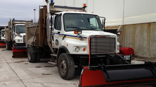
The City of Winnipeg says it has between 50 and 60 plows, 30 salt and sand trucks, and 100 workers on standby to clear out the snow. Police and firefighters are also out in full force.
In Saskatchewan, Regina remains under a winter storm watch, after it was hit with 30 cm of snow Friday and Saturday. Environment Canada warns this snow will be slow to end.
Environment Canada is also predicting lighter, fluffy snow to touch down throughout Saskatchewan, including Saskatoon and Moose Jaw. An additional two to five cm is expected by morning.
Over in Calgary, the word of the day is ice-cold, as the wind chill fell to -25 C Saturday morning. Nearly two dozen crashes were reported on Calgary roads Saturday.
The extreme weather started in Alberta, when heavy snow hit earlier this week. Residents continue to battle rough road conditions due to freezing rain and consistent snow.
About 200 sanders and graters hit Edmonton streets Saturday as all major roads were scheduled for cleaning again.
“I think that crews are doing very well and that everyone will be putting in all their efforts to get this done,” Bob Dunford, director of roadway maintenance for the city of Edmonton told CTV Edmonton.
Dunford said the ice is so thick, they will have to use abrasive measures to chip through it on city streets. A seasonal parking ban remains in effect for bus lanes but if snow clearing goes as planned, it could be lifted.
No weather warnings are currently issued for Alberta but snow is forecast for mid-week.
As for what’s responsible for this early winter, Western Canadians can blame a “Colorado low” system over the American Rockies. This system is expected to intensify and stall over Winnipeg, causing the severe weather.
Environment Canada senior climatologist Dave Phillips said there’s a good chance this snow is here to stay.
“This is the kind of snow that might be around (until) Easter, because with the colder air coming in, usually what you see is what you’re going to continue to get," Phillips told CTV News.
The same storm system is also expected to bring plenty of freezing rain, ice pellets and a bit of snow to northern Ontario as well, from Kenora in the west to North Bay in the east.
Meteorologist David Spence said just because there are snowy conditions in the early part of the season, does not mean it will carry on throughout the entire season.
“I’ve seen winters in which we’ve had big snow storms in October and November and then absolutely delightful weather the rest of the way,” Spence told CTV Calgary. “There is really no way of knowing,” he said.
Extreme weather will make its way into Northern Ontario by tonight. Forecasters are calling for less than 10 cm of snow followed by periods of ice pellets and freezing rain Sunday morning.


