Maps that show major developments in the Great War
Map design & text by Jesse Tahirali; site development by Phil Hahn
One hundred years ago, war erupted in Europe. In the four years that followed, countries had their economies ravaged, their food supplies exhausted and their young soldiers die by the hundreds of thousands.
The series of maps below detail the course of the conflict from the first declaration of war on July 28, 1914, to the final armistice and Allied victory on November 11, 1918. Also highlighted on separate maps are comparisons of casualties between nations and the high cost the First World War had on their economies.
The European geopolitical landscape has changed over the past century. The Ottoman and Austro-Hungarian empires were still in existence in 1914, and the reach of the Russian Empire extended east into what is now Finland, Belarus and Ukraine. The maps also cover the dissolution of these empires and the host of new countries that formed in the aftermath of the First World War.
Declarations of War
Use your arrow keys or the navigation tabs on the map to scroll forward.


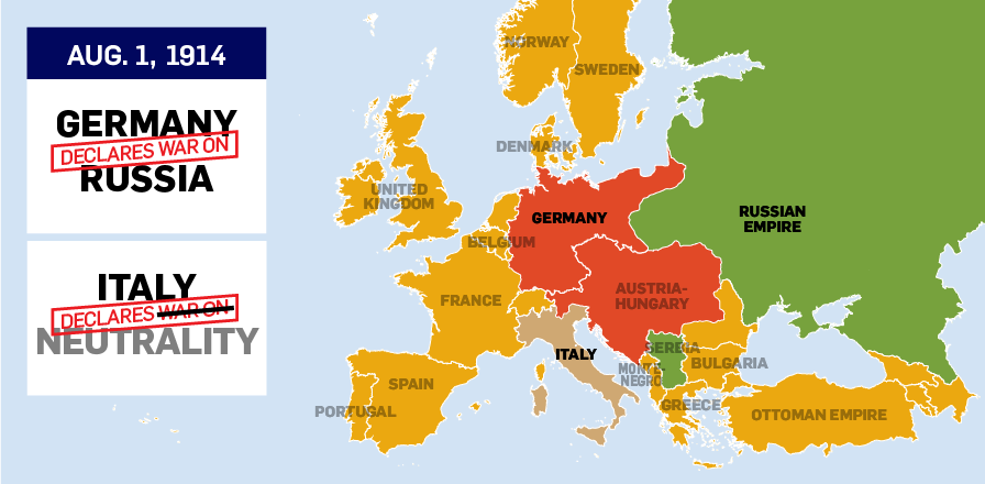
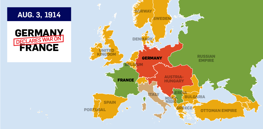

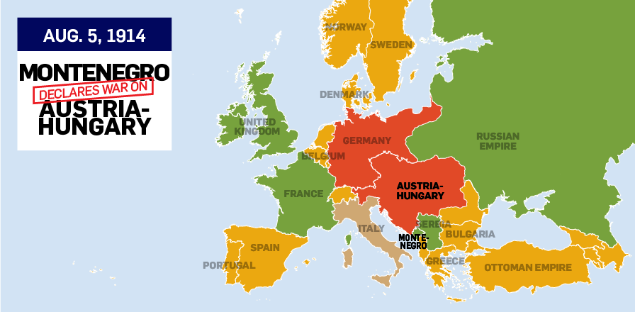
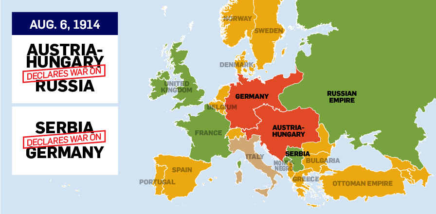
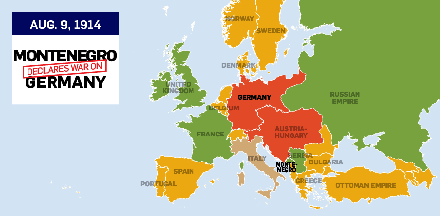
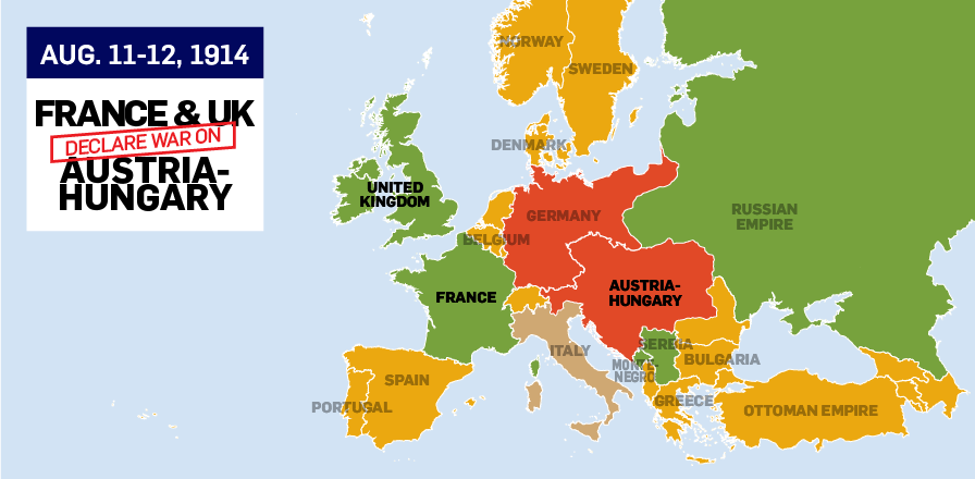
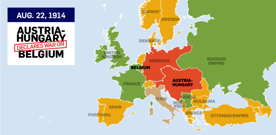


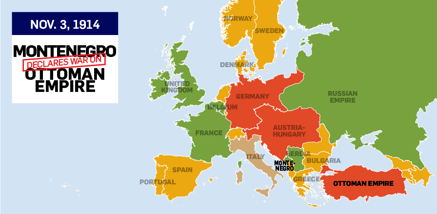

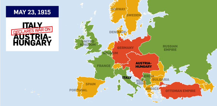
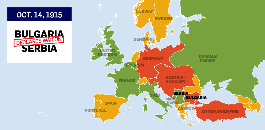
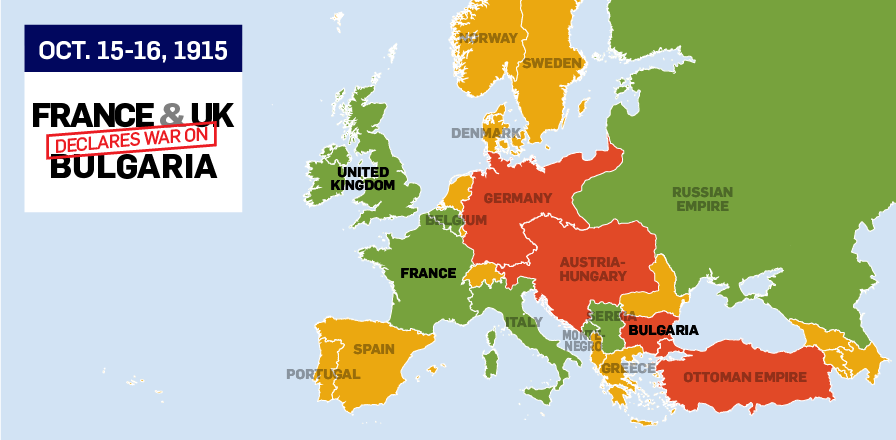
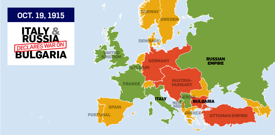
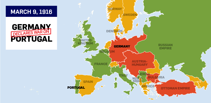
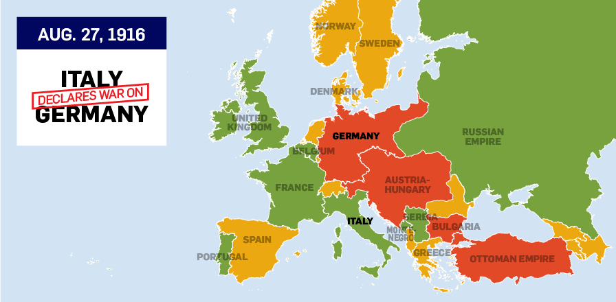
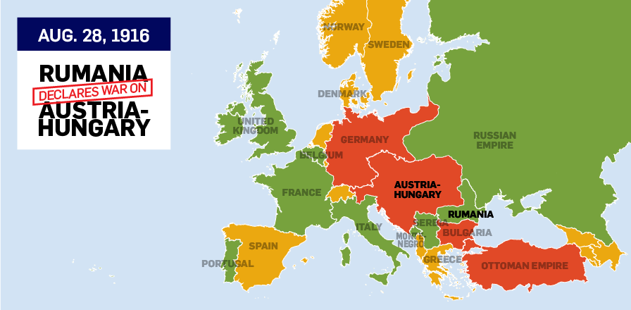
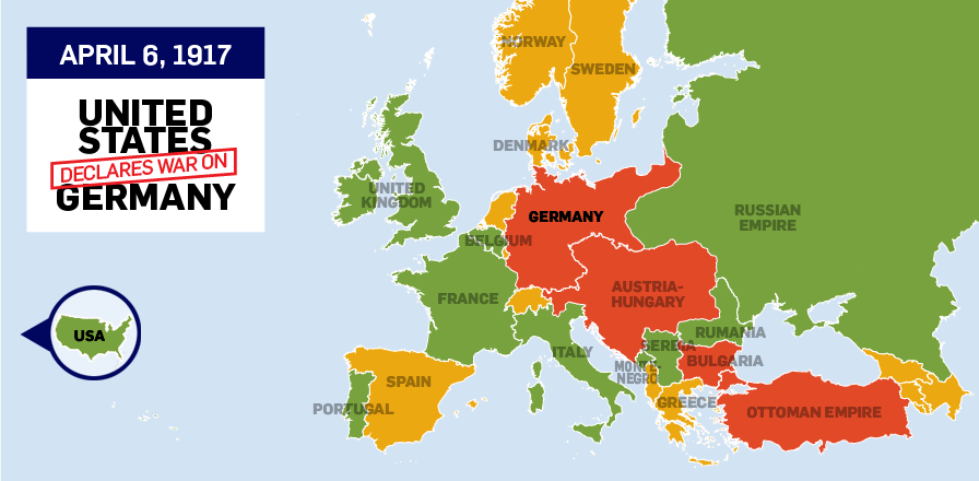


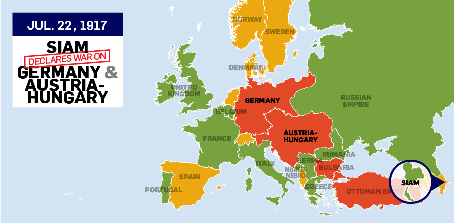

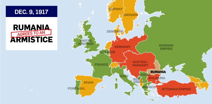
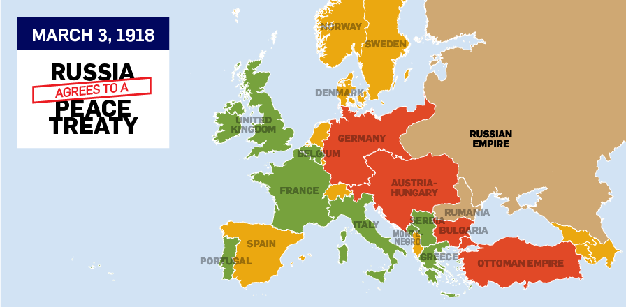
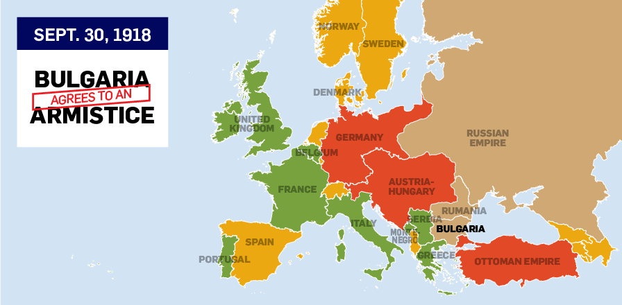


The First World War officially began on July 28, 1914, when Austria-Hungary declared war on Serbia. The assassination of Austro-Hungarian Archduke Franz Ferdinand catalyzed a chain reaction of aggression that resulted in more than 30 nations engaging in war over the next four years.
The map above highlights the dates each nation officially declared war. Countries coloured green fought on the side known as the “Entente Powers” or the “Allies,” countries coloured red fought as the “Central Powers,” yellow countries remained disengaged, and brown countries declared neutrality or agreed to peace.
Note: maps of every British Commonwealth nation do not appear in the slider above. However Britain's declaration of war on Germany on Aug. 4, 1914 automatically brought Canada and other countries under the British Commonwealth, including Canada and the Dominion of Newfoundland, into the conflict.
Many Latin American countries also declared war on Germany and Austria-Hungary in 1917 and 1918. Brazil, Costa Rica, Cuba, Guatemala, Haiti, Honduras, Nicaragua and Panama all declared war in the latter half of the conflict, though Brazil, with its naval campaign against German U-boats, was the only Latin American country to be directly involved in the fighting.
Casualties of War

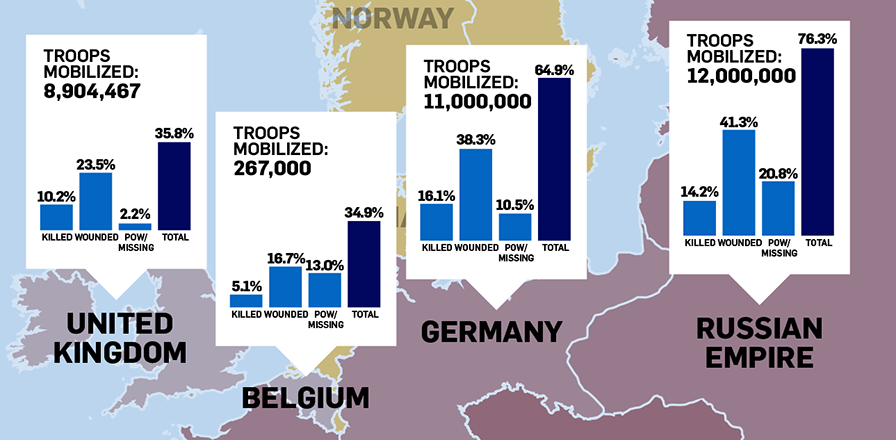

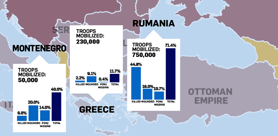
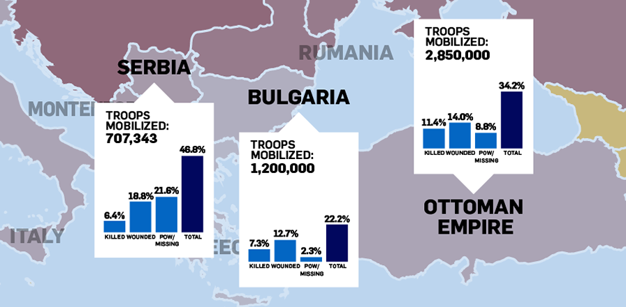
The number of soldiers killed, wounded and captured varies between sources. No definitive measure of casualties suffered in the First World War exists, but most estimates are of a similar magnitude. The above map is based on numbers compiled by PBS.
A colour-intensity map shows the percentage of casualties suffered by each nation. More than 70 per cent of French and Russian soldiers were killed, wounded or captured throughout the course of the war – though those figures pale next to Austria-Hungary’s 90 per cent casualty rate.
Click through the slider for a more detailed breakdown of casualties suffered by each nation.
Back to TopGross Domestic Product
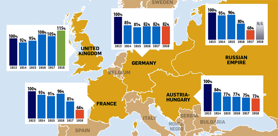
Many of the countries most heavily involved in the war suffered heavy blows to their economy. Though the United Kingdom and United States both saw modest increases to their gross domestic product by the end of the war, France, Russia, Austria-Hungary and Germany all took substantial hits to their GDP.
Back to TopWidespread Food Shortage
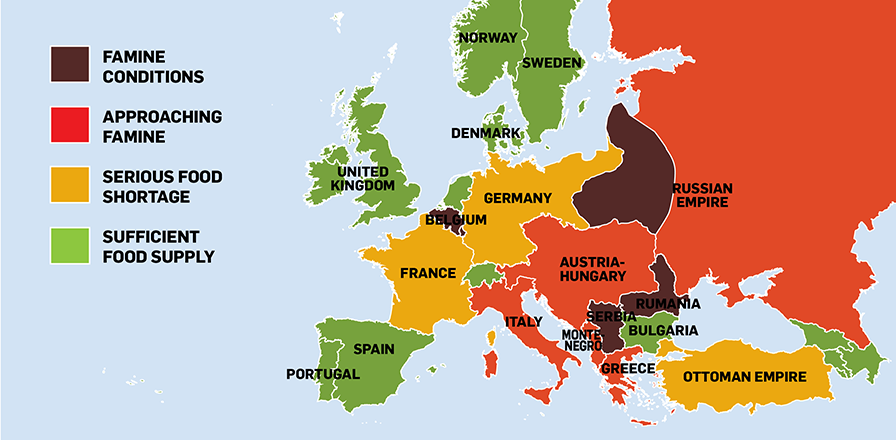
“The long war has brought hunger to Europe; some of her peoples stand constantly face to face with starvation,” wrote Herbert Hoover in the preface of a 1918 American food shortage guide.
The war left much of Europe on the brink of famine, with Belgium, Serbia, Romania (then most commonly called “Rumania”) and parts of Russia hit the hardest. The map above is a reproduction of the picture that appeared in the “Food Guide for War Service at Home,” which explained that even those with a sufficient supply of food in 1918 were facing a serious problem in the future.
Back to TopNew Nations & Borders

Following the defeat of the Central Powers in 1918, empires fell and new nations were created. A series of treaties stripped Germany, Austria-Hungary and the Russian Empire of land.
Countries like Finland, Estonia, Latvia, Lithuania and Poland were formed from Russian territory; Austria-Hungary was broken into the separate countries of Austria, Hungary, Czechoslovakia and Yugoslavia; and Rumania, Greece, France and Italy all expanded their borders following the war. Also, in 1921, the Irish Free State gained independence from Britain.
Not shown on the map is the Ottoman Empire, which became the Republic of Turkey in 1923, losing the hold it had over North Africa and Arab Asia.
Back to Top